|
|
| Mesoscale Discussion 853 | |
| < Previous MD Next MD > | |

|
|
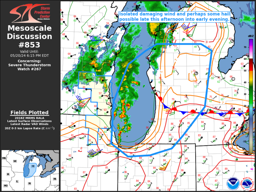
Mesoscale Discussion 0853 NWS Storm Prediction Center Norman OK 0321 PM CDT Mon May 20 2024 Areas affected...Western/central lower MI into northern IN...southern Lake Michigan Concerning...Severe Thunderstorm Watch 267... Valid 202021Z - 202215Z The severe weather threat for Severe Thunderstorm Watch 267 continues. SUMMARY...Isolated damaging wind and perhaps some hail will be possible as storms spread eastward late this afternoon into the early evening. DISCUSSION...Occasionally organized convection is ongoing from Chicagoland into southern lower MI, in association with an MCV moving across WI/northern IL. Downstream moisture/instability across lower MI remains somewhat limited, though continued heating may eventually support MLCAPE of near 1000 J/kg. Somewhat enhanced low/midlevel flow attendant to the MCV will support potential for modestly organized storms to spread eastward across the lake into lower MI late this afternoon into early evening. A nearly stationary front is draped across southern lower MI. Relatively clear skies are supporting diurnal heating on both sides of the front, though temperatures are notably warmer (well into the 80s F) to the south of the boundary. Some threat for locally damaging wind may accompany storms as they move into the region, especially near/south of the boundary where stronger heating/mixing has occurred this afternoon. Stronger embedded cells could also pose at least a transient hail threat. ..Dean/Hart.. 05/20/2024 ...Please see www.spc.noaa.gov for graphic product... ATTN...WFO...DTX...APX...IWX...GRR...LOT... LAT...LON 41418718 41768778 42858772 43868720 44228658 44408616 44388455 44218415 42728445 41978524 41648564 41518620 41468639 41418718 |
|
|
Top/All Mesoscale Discussions/Forecast Products/Home |
|


