|
|
| Mesoscale Discussion 810 | |
| < Previous MD | |

|
|
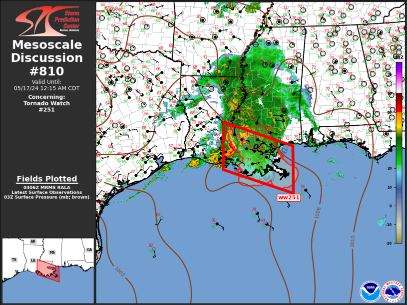
Mesoscale Discussion 0810 NWS Storm Prediction Center Norman OK 1009 PM CDT Thu May 16 2024 Areas affected...Lower Mississippi Valley Concerning...Tornado Watch 251... Valid 170309Z - 170515Z The severe weather threat for Tornado Watch 251 continues. SUMMARY...Damaging wind threat continues with surging squall line. Some tornado risk also exists along this line. DISCUSSION...Long-lived MCS continues its forward propagation across southern LA within a strong low-level warm advection regime. LLJ has increased markedly this evening ahead of the surging bow, and 0-3km SRH, just downstream at HDC, is in excess of 600 m2/s2. This complex is expected to progress along the northern instability gradient, across the remainder of southeast LA with an attendant damaging wind threat. While the primary storm mode will remain an MCS, embedded circulations along the surging bow pose some risk for tornadoes. ..Darrow.. 05/17/2024 ...Please see www.spc.noaa.gov for graphic product... ATTN...WFO...JAN...LIX...LCH... LAT...LON 31209197 30268882 28408882 29329197 31209197 |
|
|
Top/All Mesoscale Discussions/Forecast Products/Home |
|


