|
|
| Mesoscale Discussion 797 | |
| < Previous MD | |

|
|
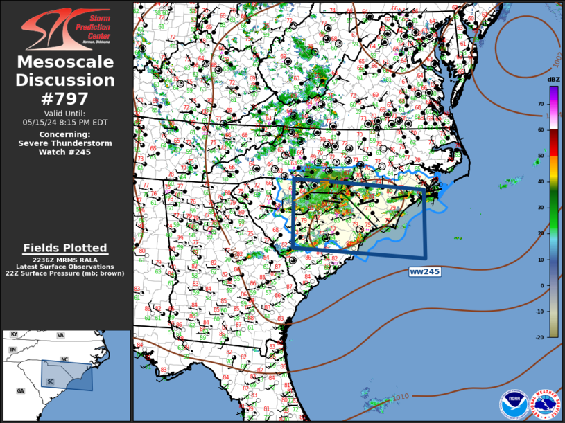
Mesoscale Discussion 0797 NWS Storm Prediction Center Norman OK 0538 PM CDT Wed May 15 2024 Areas affected...Carolinas Concerning...Severe Thunderstorm Watch 245... Valid 152238Z - 160015Z The severe weather threat for Severe Thunderstorm Watch 245 continues. SUMMARY...Scattered strong/severe convection will spread across ww245 this evening. Marginally severe hail and locally damaging winds remain possible. DISCUSSION...Water-vapor imagery depicts a mid-level vort progressing southeast across the Carolinas early this evening. Considerable amount of convection has developed ahead of this feature from southern NC into SC, where MLCAPE values are on the order of 1500 J/kg. Regional radar data suggests the vort is located over Union County NC and downstream convection is gradually growing upscale into an MCS-like cluster with embedded weak supercells. MCS will likely spread east along/near the surface boundary draped across southern NC into northern SC. Marginally severe hail and locally damaging winds remain possible with this activity. ..Darrow.. 05/15/2024 ...Please see www.spc.noaa.gov for graphic product... ATTN...WFO...MHX...RAH...ILM...CHS...CAE...GSP... LAT...LON 35198128 34897700 33027701 33308128 35198128 |
|
|
Top/All Mesoscale Discussions/Forecast Products/Home |
|


