|
|
| Mesoscale Discussion 792 | |
| < Previous MD | |

|
|
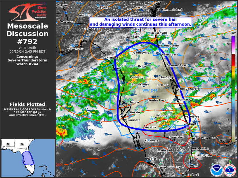
Mesoscale Discussion 0792 NWS Storm Prediction Center Norman OK 1215 PM CDT Wed May 15 2024 Areas affected...Portions of the northern/central FL Peninsula Concerning...Severe Thunderstorm Watch 244... Valid 151715Z - 151845Z The severe weather threat for Severe Thunderstorm Watch 244 continues. SUMMARY...An isolated threat for severe hail and damaging winds continues this afternoon. DISCUSSION...The strongest convection so far this afternoon across the central FL Peninsula has been near and north of Lake Okeechobee. An outflow boundary from prior convection is present across this area, with moderate to locally strong instability (2000-3000 J/kg of MLCAPE) present along and south of it per latest mesoanalysis estimates. Weak west-southwesterly low-level winds gradually strengthen with height through mid/upper levels based on recent VWPs from KTBW/KMLB. Around 40-45 kt of deep-layer shear should continue to support thunderstorm organization through the rest of the afternoon. Although convective mode has become a bit messy with multiple mergers/interactions, any semi-discrete supercells could still pose a threat for isolated severe hail given the presence of steep mid-level lapse rates. Strong to locally damaging winds will also remain a concern as filtered daytime heating aids in gradual steepening of low-level lapse rates. Across the northern FL Peninsula, the airmass is slightly less unstable. But, an isolated severe hail/wind threat may still exist downstream of ongoing convection. ..Gleason.. 05/15/2024 ...Please see www.spc.noaa.gov for graphic product... ATTN...WFO...MFL...MLB...TBW...JAX... LAT...LON 29358300 29638288 30068191 29668106 28038032 27258017 27028123 27248267 27868288 28608285 29358300 |
|
|
Top/All Mesoscale Discussions/Forecast Products/Home |
|


