| Mesoscale Discussion 789 | |
| < Previous MD | |

|
|
Mesoscale Discussion 0789
NWS Storm Prediction Center Norman OK
0223 PM CDT Tue May 19 2026
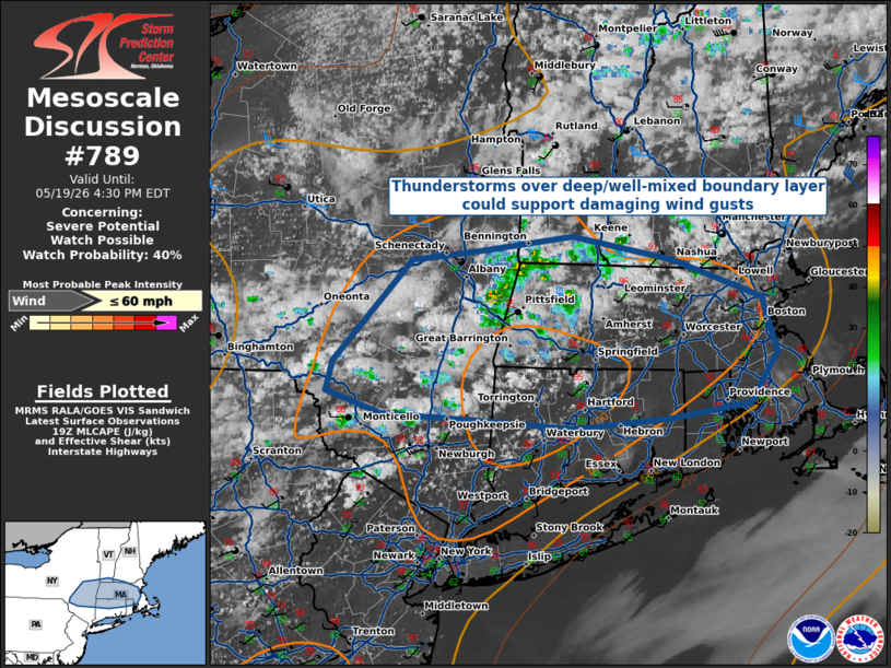
Areas affected...Portions of New England
Concerning...Severe potential...Watch possible
Valid 191923Z - 192030Z
Probability of Watch Issuance...40 percent
SUMMARY...Convective development across portions of southern New
England is occurring amidst hot, dry, and well-mixed boundary layer
profiles. While uncertainty in convective coverage exists, any
storms that develop will be capable of damaging wind gusts.
DISCUSSION...Radar trends have shown continued convective
development across portions of southern New England as surface
temperatures have risen as high as the mid-90s F. Proximity RAP
soundings show deeply-mixed and dry boundary layer profiles, and
current mesoanalysis has widespread 9 C/km lapse rates colocated
with 2000 J/kg of MLCAPE and 30 kts of deep-layer shear. There is
some uncertainty in storm coverage, as there have yet to be any
lightning detections with this convective activity -- likely due to
dry-air entrainment. Still, there is enough shear within the
environment to support some convective organization, especially with
any stronger/more robust updrafts, that would point towards a
potential damaging wind threat this afternoon.
..Halbert/Hart.. 05/19/2026
...Please see www.spc.noaa.gov for graphic product...
ATTN...WFO...GYX...BOX...OKX...ALY...BGM...
LAT...LON 42087494 42767424 42817364 42927279 42757188 42517108
42147094 41807119 41697190 41627279 41677351 41737450
41877500 42087494
MOST PROBABLE PEAK WIND GUST...UP TO 60 MPH
|
|
|
Top/All Mesoscale Discussions/Forecast Products/Home |
|
Source link