|
|
| Mesoscale Discussion 786 | |
| < Previous MD Next MD > | |

|
|
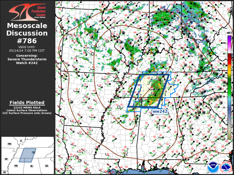
Mesoscale Discussion 0786 NWS Storm Prediction Center Norman OK 0524 PM CDT Tue May 14 2024 Areas affected...TN Valley Concerning...Severe Thunderstorm Watch 242... Valid 142224Z - 150000Z The severe weather threat for Severe Thunderstorm Watch 242 continues. SUMMARY...Gusty winds, along with some risk for marginally severe hail, will continue along the leading edge of the MCS as it propagates east this evening. DISCUSSION...MS Valley trough is advancing slowly east this evening as primary belt of stronger mid-level flow translates across the central Gulf States. Mid-level temperatures are seasonally cool north of this jet with 500mb values around -12C across the TN Valley. As a result, modest buoyancy has developed ahead of the trough with MLCAPE on the order of 1000 J/kg into middle TN. While much of this air mass has been convectively overturned, the ongoing MCS is progressing through the main instability axis and will soon begin to encounter less buoyancy. Damaging winds will likely accompany the leading edge of the surging squall line for the next few hours, but with time this activity should gradually wane over eastern TN. ..Darrow.. 05/14/2024 ...Please see www.spc.noaa.gov for graphic product... ATTN...WFO...OHX...HUN...MEG... LAT...LON 34388918 36488827 36478595 34388690 34388918 |
|
|
Top/All Mesoscale Discussions/Forecast Products/Home |
|


