|
|
| Mesoscale Discussion 785 | |
| < Previous MD Next MD > | |

|
|
   Mesoscale Discussion 0785
   NWS Storm Prediction Center Norman OK
   0507 PM CDT Tue May 14 2024

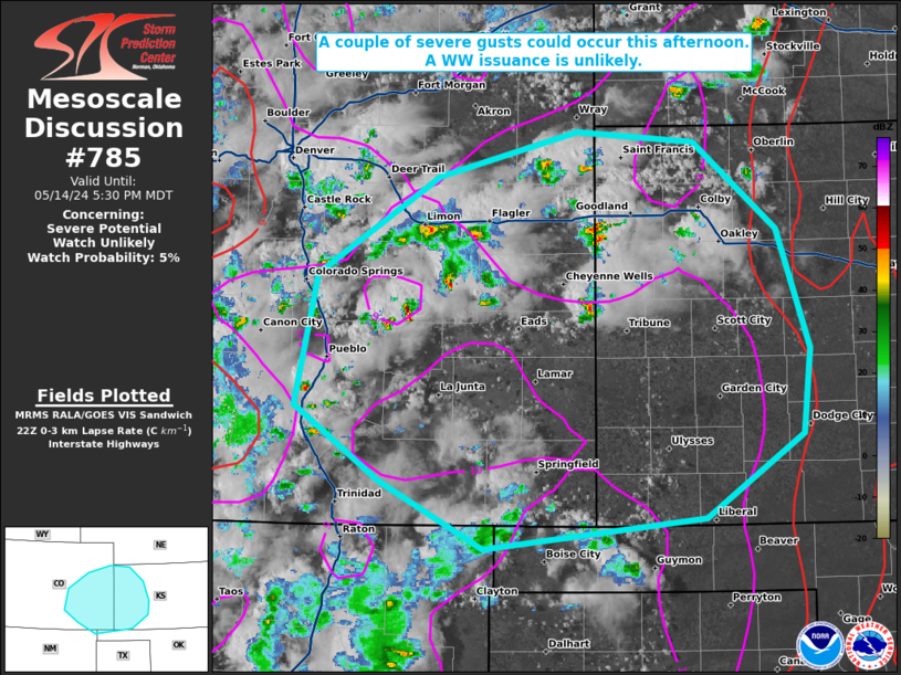
   Areas affected...portions of eastern Colorado into western Kansas

   Concerning...Severe potential...Watch unlikely

   Valid 142207Z - 142330Z

   Probability of Watch Issuance...5 percent

   SUMMARY...Isolated severe gusts are possible through the afternoon,
   and an instance or two of marginally severe hail cannot be ruled
   out. A WW issuance is not expected.

   DISCUSSION...Pulse cellular and multicellular storms have been
   percolating in intensity across portions of eastern CO into western
   KS. These storms are overspreading a deep boundary layer with large
   rainwater evaporation potential, with surface temperatures
   approaching 90 F amid low 40s dewpoints. Given the 40-50 F spreads
   and inverted-v vertical thermodynamic profiles extending to nearly
   500 mb, the ongoing storms should be high-based. 21Z mesoanalysis
   shows 9.5-10 C/km 0-3 km lapse rates within the boundary layer,
   suggesting that rainfall evaporation will support enough downward
   momentum transport to potentially produce a couple of severe gusts.
   One of the heavier/wetter storm cores may also contain some hail.
   Nonetheless, the severe threat should be isolated and a WW issuance
   is unlikely.

   ..Squitieri/Smith.. 05/14/2024

   ...Please see www.spc.noaa.gov for graphic product...

   ATTN...WFO...DDC...GLD...AMA...PUB...BOU...ABQ...

   LAT...LON   37890491 38880469 39610354 39960222 39870109 39210030
               38319999 37670007 37050099 36820310 37330410 37890491
|
|
|
Top/All Mesoscale Discussions/Forecast Products/Home |
|


