|
|
| Mesoscale Discussion 779 | |
| < Previous MD | |

|
|
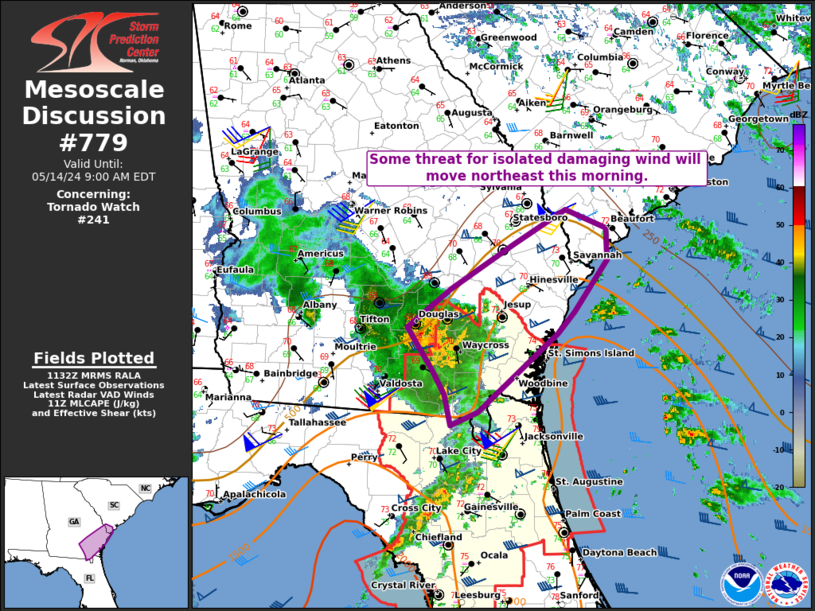
Mesoscale Discussion 0779 NWS Storm Prediction Center Norman OK 0634 AM CDT Tue May 14 2024 Areas affected...Southeast GA into extreme southern SC Concerning...Tornado Watch 241... Valid 141134Z - 141300Z The severe weather threat for Tornado Watch 241 continues. SUMMARY...Some threat for damaging wind will spread northeastward this morning. DISCUSSION...A loosely organized storm cluster is moving quickly northeastward across southeast GA this morning, with rather strong winds noted not far above the surface from the KVAX radar. Unidirectional southwesterly flow aloft (as noted on the KVAX VWP) and weak to moderate downstream buoyancy may support maintenance of this storm cluster as it moves across southeast GA this morning. While lingering near-surface stability may temper the threat to some extent, some threat for isolated damaging wind may spread northeastward out of WW 241. The longevity of this cluster this morning remains uncertain, but trends will be monitored regarding the need for downstream watch issuance. ..Dean/Guyer.. 05/14/2024 ...Please see www.spc.noaa.gov for graphic product... ATTN...WFO...CHS...JAX...FFC... LAT...LON 31458295 31828245 32268174 32588115 32418070 32098068 31598106 31398125 30628215 30498246 30798253 31048266 31458295 |
|
|
Top/All Mesoscale Discussions/Forecast Products/Home |
|


