|
|
| Mesoscale Discussion 713 | |
| < Previous MD Next MD > | |

|
|
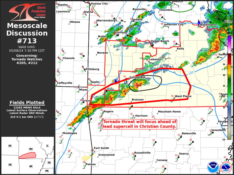
Mesoscale Discussion 0713 NWS Storm Prediction Center Norman OK 0559 PM CDT Wed May 08 2024 Areas affected...Southwest/south-central Missouri Concerning...Tornado Watch 205...212... Valid 082259Z - 090030Z The severe weather threat for Tornado Watch 205, 212 continues. SUMMARY...Tornado threat will continue in southwest Missouri ahead of a lead supercell. Large/very-large hail and damaging winds will also be possible. DISCUSSION...Storms in southwest Missouri have generally begun to train along the same areas. Outflow is evident on KSGF radar. Aside from the lead supercell, the others to the west are behind this outflow. The lead supercell will continue to be the focus for tornado potential for the next 1-2 hours. Significant hail was also recently reported with this lead storm. The supercells farther west will still be capable of large to very-large hail as well as isolated damaging wind gusts as the move eastward. ..Wendt.. 05/08/2024 ...Please see www.spc.noaa.gov for graphic product... ATTN...WFO...SGF... LAT...LON 36809447 37069388 37349291 37499223 37479158 37019132 36699143 36669194 36689210 36559381 36559453 36809447 |
|
|
Top/All Mesoscale Discussions/Forecast Products/Home |
|


