|
|
| Mesoscale Discussion 698 | |
| < Previous MD | |

|
|
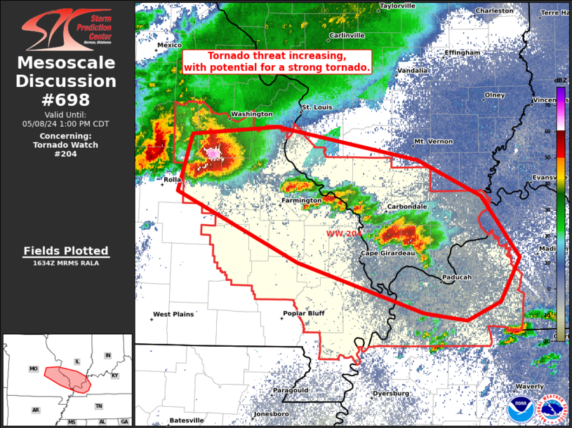
Mesoscale Discussion 0698 NWS Storm Prediction Center Norman OK 1135 AM CDT Wed May 08 2024 Areas affected...Southeast MO...southern IL...and far western KY Concerning...Tornado Watch 204... Valid 081635Z - 081800Z CORRECTED FOR WATCH NUMBER The severe weather threat for Tornado Watch 204 continues. SUMMARY...Tornado threat is increasing across southeast Missouri, into southern Illinois, and far western Kentucky. This will include potential for cyclical tornadogenesis and a strong (EF2-EF3) tornado. DISCUSSION...Long-lived/tracked supercell centered on northern Crawford/southern Franklin counties in MO as of 1620Z has fully transitioned from earlier elevated character to surface-based. Measured severe gusts up to 58 kt have been reported in the past hour at the Vichy ASOS. It will likely persist along the composite outflow that extends southeastward, where additional supercells are maturing in far southern IL. The strongest low-level flow across the region remains in southern MO per SGF VWP data, with somewhat weaker but more veering with height over the MS/OH Valley confluence per the PAH VWP data. This will yield an STP environment of 1-3 across the region, supportive of a strong tornado. Overall convective mode will probably become increasingly complex with time as considerable storm-scale consolidation occurs through the afternoon, but occasional attempts at tornadogenesis should occur with multiple embedded supercells. ..Grams.. 05/08/2024 ...Please see www.spc.noaa.gov for graphic product... ATTN...WFO...PAH...LSX...SGF... LAT...LON 38429142 38489045 38198884 37858812 37308770 36898792 36738829 36798878 37269021 37899159 38429142 |
|
|
Top/All Mesoscale Discussions/Forecast Products/Home |
|


