|
|
| Mesoscale Discussion 696 | |
| < Previous MD Next MD > | |

|
|
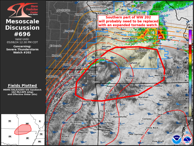
Mesoscale Discussion 0696 NWS Storm Prediction Center Norman OK 1101 AM CDT Wed May 08 2024 Areas affected...Southwest/south-central MO...northeast OK...northwest AR Concerning...Severe Thunderstorm Watch 202... Valid 081601Z - 081730Z The severe weather threat for Severe Thunderstorm Watch 202 continues. SUMMARY...With additional storms gradually developing south of WW 202, and the overall environment becoming increasingly favorable for a tornado threat during the afternoon, a new tornado watch that replaces the southern part of WW 202 will be needed prior to its 19Z scheduled expiration. DISCUSSION...While the bulk of supercell clustering has persisted in central MO, additional storms have gradually developed near the OK/KS/MO border area, just southwest of WW 202. This activity is within the low-level warm theta-e advection regime, east of the southeast-sagging cold front that lags in southeast KS to central OK. This development has been slow and sub-severe thus far. But as additional boundary-layer warming continues, especially across eastern OK, along with strengthening low-level convergence as the front impinges, this leading activity should intensify during the early afternoon. While very large hail and isolated severe gusts will be possible, the presence of 35-45 kt low-level southwesterlies per SGF/INX/SRX VWP data will yield favorable hodograph enlargement for a few tornadic storms. Potential for a strong tornado may become maximized near the composite outflow/warm front across southwest to south-central MO. ..Grams.. 05/08/2024 ...Please see www.spc.noaa.gov for graphic product... ATTN...WFO...LZK...SGF...TSA... LAT...LON 37899253 37769168 37009133 36619138 36059259 35839431 35859505 36059555 36539550 37209486 37749403 37879368 37899253 |
|
|
Top/All Mesoscale Discussions/Forecast Products/Home |
|


