|
|
| Mesoscale Discussion 695 | |
| < Previous MD | |

|
|
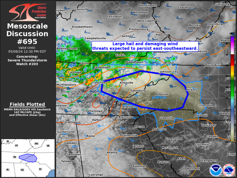
Mesoscale Discussion 0695 NWS Storm Prediction Center Norman OK 0956 AM CDT Wed May 08 2024 Areas affected...Eastern TN and western NC Concerning...Severe Thunderstorm Watch 203... Valid 081456Z - 081630Z The severe weather threat for Severe Thunderstorm Watch 203 continues. SUMMARY...A pair of supercells will pose threats for large hail of 1-1.75 inches in diameter and damaging winds from 55-70 mph as they likely persist east-southeast across the remainder of eastern Tennessee and into western North Carolina. DISCUSSION...A pair of long-lived supercells, the easternmost of which appears to be the more intense of the two, are steadily tracking east-southeast across eastern TN. The downstream air mass continues to destabilize, with surface temperatures having warmed through the 60s to low 70s over the Great Smoky and Blue Ridge Mountains, and through the 70s to low 80s across the adjacent Piedmont. This will support the eastern extension of the TN Valley buoyancy plume which was characterized by MLCAPE of 2000-2500 J/kg per the 12Z BNA sounding. While low-level shear will remain weak per MRX VWP data, strong mid to upper-level westerlies will support persistence of discrete supercells which may consolidate into a cluster as they emerge east of the higher terrain in the early afternoon. ..Grams.. 05/08/2024 ...Please see www.spc.noaa.gov for graphic product... ATTN...WFO...RNK...GSP...MRX... LAT...LON 36398306 36248183 35908136 35668125 35248147 35138202 35268304 35508386 35738461 36048458 36398306 |
|
|
Top/All Mesoscale Discussions/Forecast Products/Home |
|


