|
|
| Mesoscale Discussion 683 | |
| < Previous MD | |

|
|
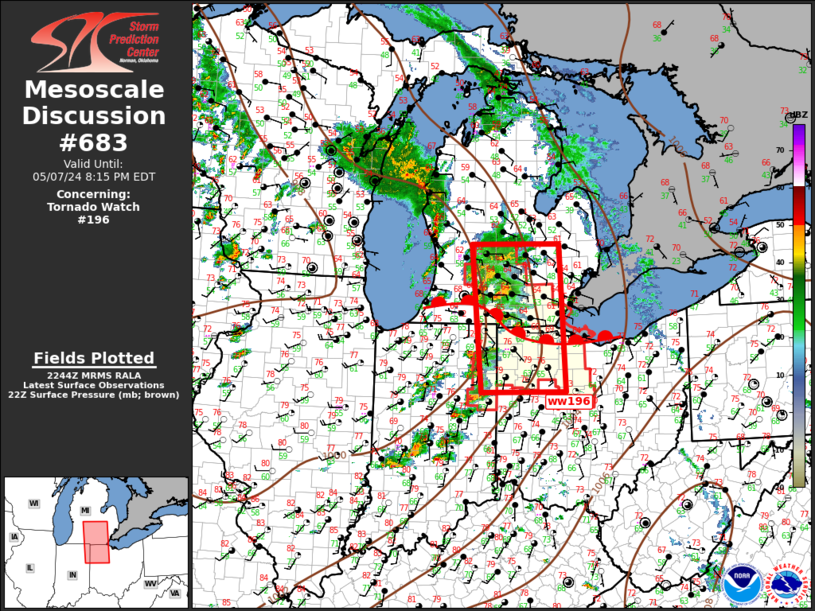
Mesoscale Discussion 0683 NWS Storm Prediction Center Norman OK 0546 PM CDT Tue May 07 2024 Areas affected...Southern Lower MI...Northeast IN...Northwest OH Concerning...Tornado Watch 196... Valid 072246Z - 080015Z The severe weather threat for Tornado Watch 196 continues. SUMMARY...Supercells will spread northeast this evening. Tornado threat continues, along with large hail. DISCUSSION...Exit region of mid-level speed max is spreading across the central Great Lakes region early this evening. Approaching short wave/speed max is contributing to a slow northward advance of surface warm front that currently drapes across northern OH into southern MI. No less than half a dozen long-lived supercells are currently noted near this warm front, several of which are, or have been tornadic. Additionally, very large hail has been noted at times. This activity will continue spreading northeast over the next few hours. Greatest tornado threat will be near and just south of this warm front as buoyancy drops considerably north of the wind shift. A bit south of the warm front, discrete supercells are gradually increasing in intensity across eastern IN. Longer-lived updrafts will spread into the OH portion of ww196 in the next 1-2 hours. ..Darrow.. 05/07/2024 ...Please see www.spc.noaa.gov for graphic product... ATTN...WFO...CLE...ILN...DTX...IWX...GRR... LAT...LON 40608515 43108537 43118340 40618326 40608515 |
|
|
Top/All Mesoscale Discussions/Forecast Products/Home |
|