|
|
| Mesoscale Discussion 681 | |
| < Previous MD | |

|
|
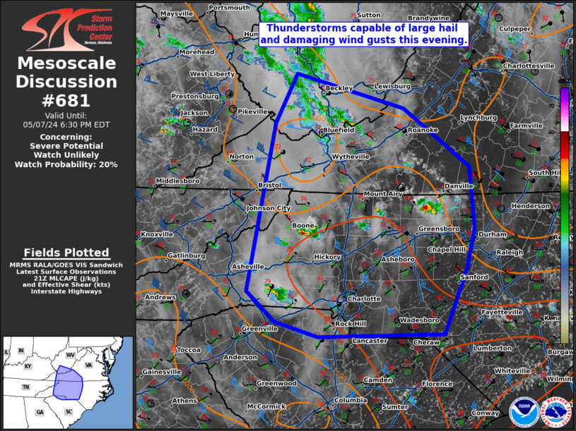
   Mesoscale Discussion 0681
   NWS Storm Prediction Center Norman OK
   0405 PM CDT Tue May 07 2024

   Areas affected...western/central North Carolina and western
   Virginia.

   Concerning...Severe potential...Watch unlikely

   Valid 072105Z - 072230Z

   Probability of Watch Issuance...20 percent

   SUMMARY...Strong thunderstorms capable of hail and damaging wind
   gusts are possible this evening.

   DISCUSSION...A few storms have formed over the mountains and are
   moving toward greater instability across central North Carolina this
   afternoon. Amid around 30 to 35 knots of effective shear (per SPC
   mesoanalysis), storms have been organized with some supercell
   structures apparent. Given the supercell storm mode and moderate to
   strong instability and increasing shear through the evening, there
   will be a threat for large hail and damaging wind gusts with these
   storms. Height rises and synoptic scale subsidence should keep storm
   coverage isolated and end the threat by sunset which should preclude
   the need for a watch.

   ..Bentley/Hart.. 05/07/2024

   ...Please see www.spc.noaa.gov for graphic product...

   ATTN...WFO...RAH...RNK...RLX...CAE...GSP...MRX...

   LAT...LON   37418191 38018159 37587997 36887899 36137892 35657904
               34847939 34828125 34998189 35368232 37418191
|
|
|
Top/All Mesoscale Discussions/Forecast Products/Home |
|