|
|
| Mesoscale Discussion 669 | |
| < Previous MD | |

|
|
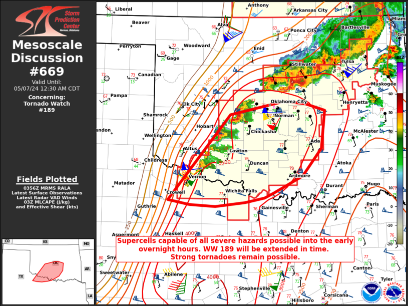
Mesoscale Discussion 0669 NWS Storm Prediction Center Norman OK 1059 PM CDT Mon May 06 2024 Areas affected...Southwest into central OK...western north TX Concerning...Tornado Watch 189... Valid 070359Z - 070530Z The severe weather threat for Tornado Watch 189 continues. SUMMARY...Supercells capable of all severe hazards will spread eastward into the early overnight hours. Strong tornadoes remain possible. WW 189 will be extended in time. DISCUSSION...Storms have recently developed in the vicinity of the Pacific cold front in southwest OK. Downstream, the 03Z OUN sounding indicates a very favorable environment remains in place across central OK, with strong buoyancy, effective shear of 60+ kt, and 0-1 km SRH of greater than 300 m2/s2. A threat for supercells will move quickly eastward into the early overnight hours, with a threat of all severe hazards. Strong to intense tornadoes remain possible if discrete supercells can be maintained. WW 189 will be extended in time to cover this threat. ..Dean.. 05/07/2024 ...Please see www.spc.noaa.gov for graphic product... ATTN...WFO...TSA...FWD...OUN... LAT...LON 33819967 35299836 35539723 35489679 35379637 34709644 34229684 33949745 33859764 33779806 33709868 33729922 33789954 33819967 |
|
|
Top/All Mesoscale Discussions/Forecast Products/Home |
|


