|
|
| Mesoscale Discussion 661 | |
| < Previous MD | |

|
|
   Mesoscale Discussion 0661
   NWS Storm Prediction Center Norman OK
   0618 PM CDT Mon May 06 2024

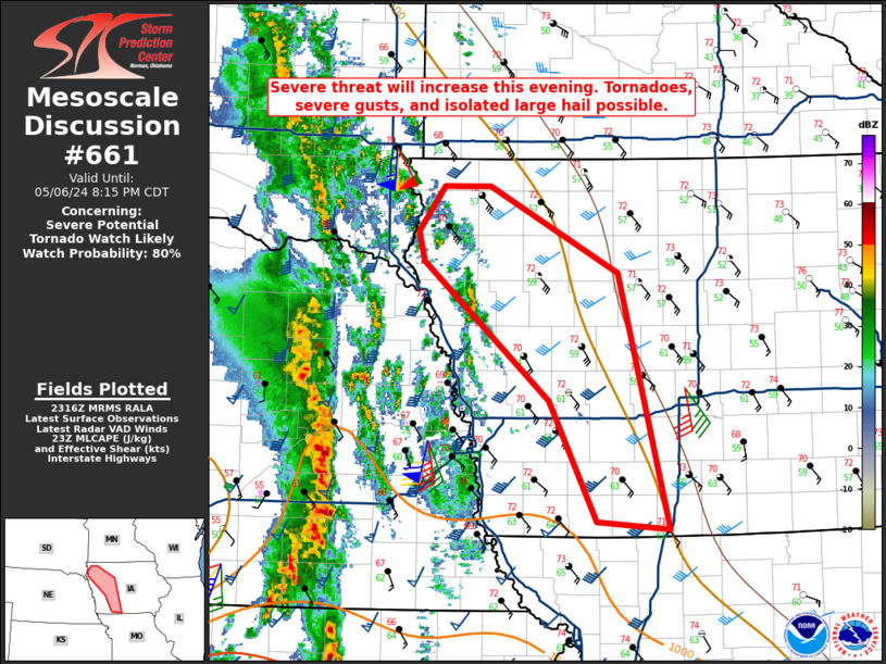
   Areas affected...Portions of western/central Iowa

   Concerning...Severe potential...Tornado Watch likely

   Valid 062318Z - 070115Z

   Probability of Watch Issuance...80 percent

   SUMMARY...Storms will move east-northeast out of Nebraska into
   western and eventually parts of central Iowa. Damaging winds and
   QLCS tornadoes will be possible.

   DISCUSSION...Aided my the mid-level shortwave trough, a line of
   convection continues to the east-northeast in eastern Nebraska. This
   will likely continue into parts of western into central Iowa this
   evening. Dewpoints have risen into the low 60s F in the mid-Missouri
   Valley. Though overall destabilization has not been robust due to
   cloud cover, the upper-level forcing and continued moisture
   advection should promote some severe threat. Regional VAD profiles
   from KFSD/KOAX/KDMX show ample low-level shear in place. This shear
   should remain and increase as the low-level jet intensifies and
   moves east. Damaging winds and QLCS tornadoes will be possible. A
   tornado watch will likely be needed this evening. The primary
   uncertainty will be how far north/northwest the severe threat will
   be.

   ..Wendt/Guyer.. 05/06/2024

   ...Please see www.spc.noaa.gov for graphic product...

   ATTN...WFO...DMX...FSD...OAX...

   LAT...LON   40689462 41629511 42709641 42939647 43299620 43299572
               42619440 40629387 40689462
|
|
|
Top/All Mesoscale Discussions/Forecast Products/Home |
|


