|
|
| Mesoscale Discussion 516 | |
| < Previous MD | |
|
|
Mesoscale Discussion 0516
NWS Storm Prediction Center Norman OK
0217 PM CDT Tue Apr 22 2025
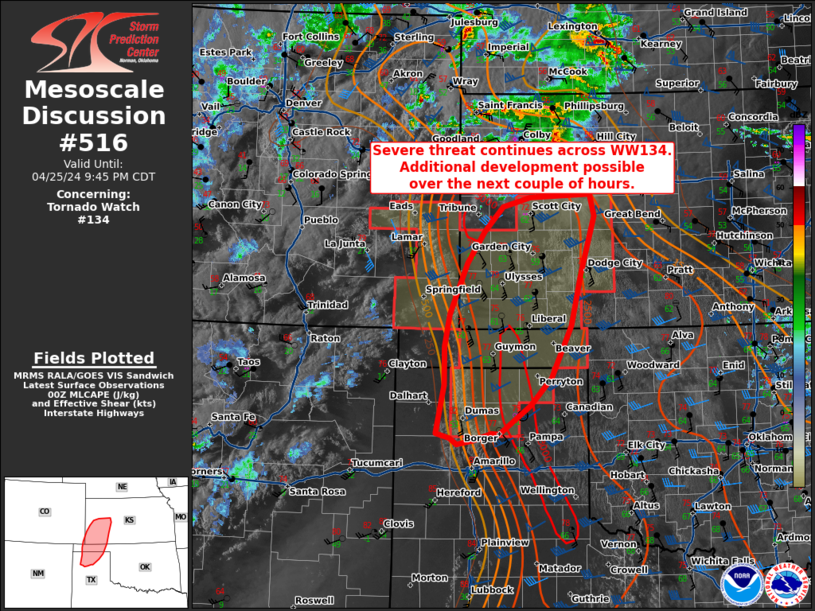
Areas affected...southwestern Texas
Concerning...Severe potential...Watch likely
Valid 221917Z - 222115Z
Probability of Watch Issuance...80 percent
SUMMARY...Damaging wind and hail risk to increase through the
afternoon/evening.
DISCUSSION...Surface analysis shows the dryline extending across the
Texas Panhandle into far eastern New Mexico and southward to the
Texas Big Bend as on 19z. Daytime heating under mostly sunny skies
has led temperatures to rise into the 80s (some mid to upper 80s
further south near the Mexico border). Satellite data shows towering
cu, mainly near and adjacent to the higher terrain of the Cap Rock
and Stockton Plateau. Morning observed soundings from AMA and LUB
would suggest that convective temperatures are around 80-85 F, which
in combination with increase in towering cu suggests initiation over
the next 1-2 hours.
Initial development will likely be supercellular. Though flow aloft
and deep layer shear are more marginal, MLCAPE around 1500-2500 J/kg
and steep low to mid-level lapse rates will support potential for
large hail (some very large 2"+) and damaging wind. Where discrete
modes can interact with outflow/boundaries enhancing surface
vorticity, a tornado could be possible. As storms increase in
coverage this afternoon, clustering along outflows will tend to
create mixed mode of supercells and multi-cells, with an increase in
potential for damaging wind (some 70-80 mph). A watch will be needed
to cover these threats soon.
..Thornton/Hart.. 04/22/2025
...Please see www.spc.noaa.gov for graphic product...
ATTN...WFO...OUN...EWX...SJT...LUB...MAF...
LAT...LON 30330324 30810329 32170307 33380255 33460253 34230188
34610130 34640111 34370061 34050021 33809998 33559982
33259958 32669958 32059983 30800052 29750114 29760201
29730247 29540279 29650307 29910321 30330324
MOST PROBABLE PEAK TORNADO INTENSITY...UP TO 95 MPH
MOST PROBABLE PEAK WIND GUST...65-80 MPH
MOST PROBABLE PEAK HAIL SIZE...1.50-2.50 IN
|
|
|
Top/All Mesoscale Discussions/Forecast Products/Home |
|
Source link