|
|
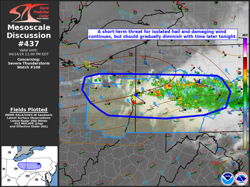
| Mesoscale Discussion 437 | |
| < Previous MD | |
|
|
Mesoscale Discussion 0437 NWS Storm Prediction Center Norman OK 0335 PM CDT Mon Apr 07 2025 Areas affected...parts of NC SC and southern VA Concerning...Severe Thunderstorm Watch 134... Valid 072035Z - 072130Z The severe weather threat for Severe Thunderstorm Watch 134 continues. SUMMARY...The damaging wind threat continues across WW134, primarily with the band of storms moving over eastern NC and southern VA. However, additional storms remain possible farther south. DISCUSSION...As of 2040 UTC, regional radar imagery shows an organized linear cluster of thunderstorms ongoing from far southeastern VA into eastern NC. Over the last 2 hours, several reports of wind damage, and measured severe gusts have been reported with the line segment across parts of VA and NC. This appears likely to continue to the coast as the line segment moves east-northeast at 50 kt. Farther south, lingering cloud cover has resulted in only isolated weak convection and showers across parts of SC. Some recent CA guidance suggests a few stronger cells may eventually emerge closer to the coast where heating has been more pronounced. A damaging wind gusts threat could evolve with any deeper connective cells that become established in the next couple of hours as the primary cold front continues to shift east. ..Lyons.. 04/07/2025 ...Please see www.spc.noaa.gov for graphic product... ATTN...WFO...AKQ...MHX...RAH...ILM...CAE... LAT...LON 34148002 35577811 36327716 36667645 36757605 36377560 35767544 35217554 34677632 34347712 34207793 33637912 33627965 33718001 34148002 MOST PROBABLE PEAK TORNADO INTENSITY...UP TO 95 MPH MOST PROBABLE PEAK WIND GUST...65-80 MPH |
|
|
Top/All Mesoscale Discussions/Forecast Products/Home |
|
Source link