| Mesoscale Discussion 420 | |
| < Previous MD Next MD > | |

|
|
   Mesoscale Discussion 0420
   NWS Storm Prediction Center Norman OK
   0103 PM CDT Tue Apr 14 2026

   Areas affected...portions of northern and eastern Ohio into western
   Pennsylvania

   Concerning...Severe potential...Watch possible

   Valid 141803Z - 141930Z

   Probability of Watch Issuance...40 percent

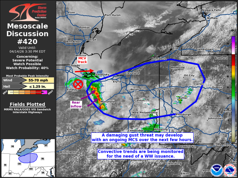
   SUMMARY...Multiple damaging gusts may accompany an MCS over the next
   few hours. While the efficiency in severe gust production is in
   question, convective trends will be monitored for the need of a
   Severe Thunderstorm Watch issuance.

   DISCUSSION...Deep-moist convection has developed and become
   established immediately ahead of an eastward tracking MCV. This MCS
   will track eastward along a corridor of modest deep-layer shear and
   500-1000 J/kg MLCAPE. Given the relatively lower-end buoyancy/shear
   parameter space, it is not clear how efficient the MCS will be at
   producing damaging or especially severe gusts. However, KCLE
   cross-sectional storm relative velocity data does depict weak
   descending rear-inflow features, and the deep-layer shear vector is
   oriented roughly normal to the orientation of the leading line. As
   such, some damaging (and perhaps severe) gust potential exists.
   There is also a chance for an instance or two of hail. Convective
   trends will continue to be monitored for the need of a WW issuance,
   but the severe threat may be too isolated to warrant an issuance.

   ..Squitieri/Gleason.. 04/14/2026

   ...Please see www.spc.noaa.gov for graphic product...

   ATTN...WFO...CTP...PBZ...CLE...

   LAT...LON   40517981 40378100 40378187 40518238 40698264 40898287
               41088295 41298279 41428234 41808096 41898011 41767919
               41377898 40827929 40517981

   MOST PROBABLE PEAK WIND GUST...55-70 MPH
   MOST PROBABLE PEAK HAIL SIZE...UP TO 1.25 IN
|
|
|
Top/All Mesoscale Discussions/Forecast Products/Home |
|
Source link


