| Mesoscale Discussion 382 | |
| < Previous MD | |

|
|
   Mesoscale Discussion 0382
   NWS Storm Prediction Center Norman OK
   0344 PM CDT Sat Apr 11 2026

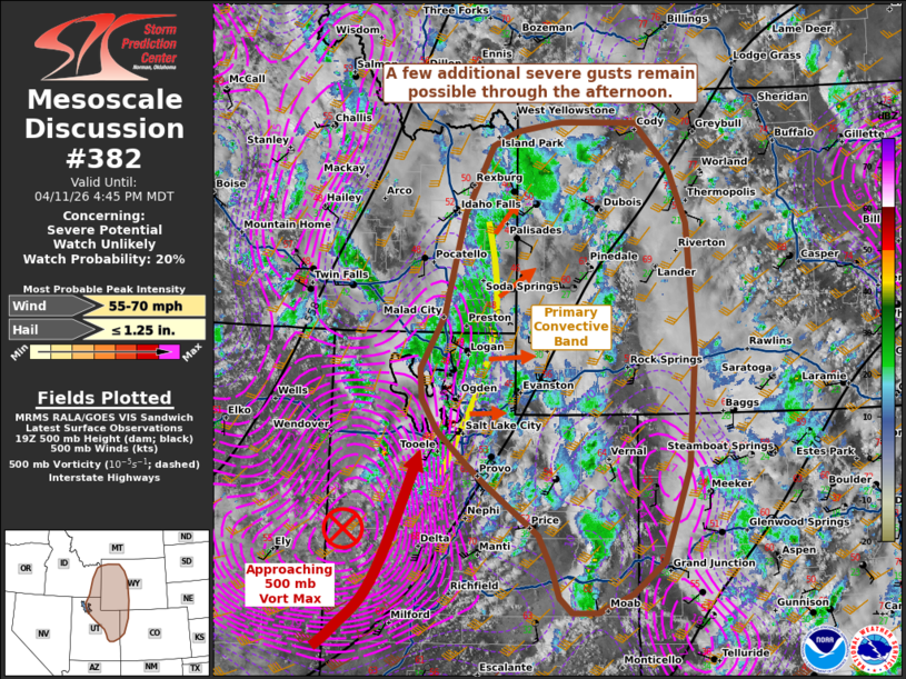
   Areas affected...portions of southeastern Idaho...northeastern
   Utah...extreme northwest Colorado...western Wyoming

   Concerning...Severe potential...Watch unlikely

   Valid 112044Z - 112245Z

   Probability of Watch Issuance...20 percent

   SUMMARY...A few additional severe gusts are still possible with the
   stronger storms, and an instance or two of hail cannot be ruled out.

   DISCUSSION...At least scattered thunderstorms persist immediately
   ahead of a well-defined mid-level vorticity maximum, which continues
   to overspread the central/northern Rockies. Multiple severe gusts
   have been measured, with some hail reported as well with the primary
   convective band along the UT/ID/WY border area. 20Z mesoanalysis
   depicts 500-1000 J/kg amid 30 kts of effective bulk shear preceding
   the storms, suggesting that additional severe gusts and even some
   hail may still occur with the stronger storms. The severe threat is
   still expected to remain isolated, with a WW issuance still
   unlikely.

   ..Squitieri/Mosier.. 04/11/2026

   ...Please see www.spc.noaa.gov for graphic product...

   ATTN...WFO...RIW...GJT...TFX...SLC...PIH...

   LAT...LON   40350820 39170862 38760913 38540970 38531011 38721032
               39101044 39501065 40121152 40381185 40781231 41171257
               41551261 42191222 43461191 44301144 44491105 44611031
               44590906 44050851 43350821 41750809 40350820

   MOST PROBABLE PEAK WIND GUST...55-70 MPH
   MOST PROBABLE PEAK HAIL SIZE...UP TO 1.25 IN
|
|
|
Top/All Mesoscale Discussions/Forecast Products/Home |
|
Source link


