| Mesoscale Discussion 304 | |
| < Previous MD | |

|
|
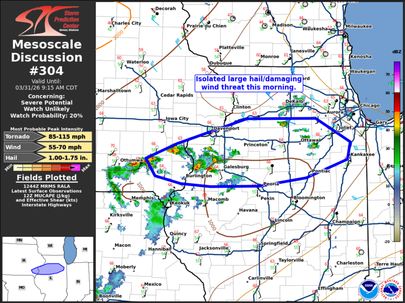
   Mesoscale Discussion 0304
   NWS Storm Prediction Center Norman OK
   0746 AM CDT Tue Mar 31 2026

   Areas affected...north-central Illinois and far eastern Iowa.

   Concerning...Severe potential...Watch unlikely

   Valid 311246Z - 311415Z

   Probability of Watch Issuance...20 percent

   SUMMARY...Isolated large hail/damaging wind threat this morning.

   DISCUSSION...Several storms have developed within the last hour
   across southeast Iowa and far western Illinois ahead of a weak
   mid-level trough where some low-level jet enhancement is also
   present. These cells are quite small, but are rotating and seem to
   be relatively efficient hail producers (already 1 report of 1 inch
   hail in eastern Iowa). The primary hail threat will likely be early
   in the storm cycles before they congeal and some damaging wind
   threat may develop. However, relatively weak instability this
   morning should mitigate the overall threat. Therefore, no watch is
   anticipated.

   ..Bentley/Mosier.. 03/31/2026

   ...Please see www.spc.noaa.gov for graphic product...

   ATTN...WFO...LOT...ILX...DVN...

   LAT...LON   41119189 41339126 41718989 41728852 41368783 41098790
               40838872 40718963 40699061 40749119 40849169 41119189

   MOST PROBABLE PEAK TORNADO INTENSITY...85-115 MPH
   MOST PROBABLE PEAK WIND GUST...55-70 MPH
   MOST PROBABLE PEAK HAIL SIZE...1.00-1.75 IN
|
|
|
Top/All Mesoscale Discussions/Forecast Products/Home |
|
Source link