|
|
| Mesoscale Discussion 2310 | |
| < Previous MD | |

|
|
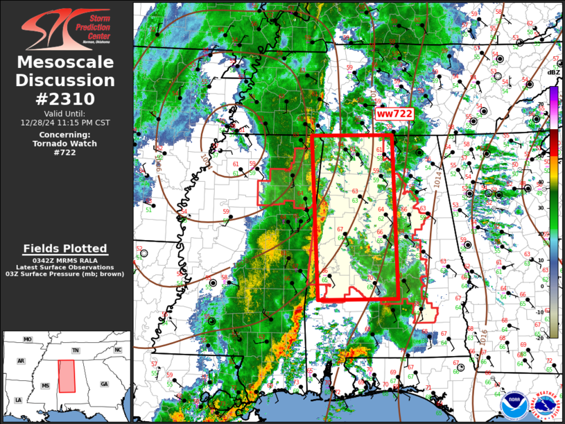
Mesoscale Discussion 2310 NWS Storm Prediction Center Norman OK 0943 PM CST Sat Dec 28 2024 Areas affected...Northern/Central Alabama Concerning...Tornado Watch 722... Valid 290343Z - 290515Z The severe weather threat for Tornado Watch 722 continues. SUMMARY...Severe squall line will propagate across Alabama late this evening. DISCUSSION...Severe QLCS is propagating steadily east, in response to a strongly dynamic trough that is ejecting across the lower MS Valley. This linear MCS has surged 100-150mi ahead of the synoptic front, with the leading edge of the squall line now roughly extending along the AL/MS border. Intense LLJ has aided some northward destabilization, with lower 60s surface dew points noted to near the TN/AL border. Damaging winds can be expected with this MCS, along with some risk for tornadoes, especially with embedded supercells. This line is expected to advance across the remainder of ww722 into eastern AL after 07z. ..Darrow.. 12/29/2024 ...Please see www.spc.noaa.gov for graphic product... ATTN...WFO...OHX...BMX...HUN...MOB...MEG...JAN... LAT...LON 32028818 34998835 35008659 32048649 32028818 |
|
|
Top/All Mesoscale Discussions/Forecast Products/Home |
|


