|
|
| Mesoscale Discussion 2304 | |
| < Previous MD Next MD > | |

|
|
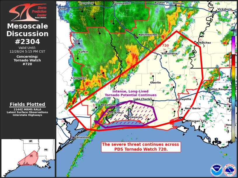
Mesoscale Discussion 2304 NWS Storm Prediction Center Norman OK 0346 PM CST Sat Dec 28 2024 Areas affected...far southeast Texas into central Louisiana Concerning...Tornado Watch 720... Valid 282146Z - 282315Z The severe weather threat for Tornado Watch 720 continues. SUMMARY...The severe threat continues across Particularly Dangerous Situation Tornado Watch 720. The greatest threat for significant tornadoes remains with a supercell across coastal southeast TX, though QLCS tornadoes remain possible across LA. DISCUSSION...A lone supercell across far southeast Coastal TX has produced a likely intense tornado that may have persisted for over 90 minutes, and is likely still be in progress. Even if this tornado dissipates soon, the parent steady-state supercell will continue to move along the coastline with continued significant tornado potential for at least the next few hours. Meanwhile, farther to the northeast, a QLCS continues to gradually organize and mature, with KPOE regional radar data suggesting that leading-line mesovortices and perhaps QLCS tornadoes may be developing. Current thinking is that the QLCS will persist across western into central LA with damaging gust and tornado potential through the remainder of the afternoon and early evening. ..Squitieri.. 12/28/2024 ...Please see www.spc.noaa.gov for graphic product... ATTN...WFO...JAN...LIX...LCH...SHV...HGX... LAT...LON 29989494 31179301 31889201 31509135 30759129 30159157 29799186 29619260 29589343 29519413 29549446 29989494 |
|
|
Top/All Mesoscale Discussions/Forecast Products/Home |
|


