| Mesoscale Discussion 23 | |
| < Previous MD | |

|
|
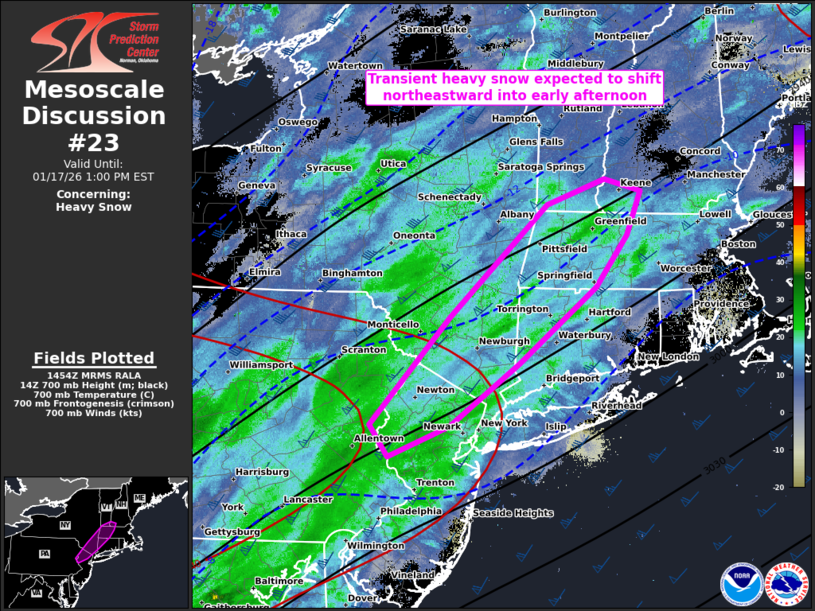
   Mesoscale Discussion 0023
   NWS Storm Prediction Center Norman OK
   0855 AM CST Sat Jan 17 2026

   Areas affected...northern NJ into southwest New England

   Concerning...Heavy snow

   Valid 171455Z - 171800Z

   SUMMARY...Transient heavy snow is expected to shift northeastward in
   the Northeast to southwest New England through early afternoon.
   Rates should briefly reach 1 inch per hour before waning.

   DISCUSSION...A confined band of moderate to heavy snow with several
   half to quarter-mile visibilities ongoing across mainly southeast
   PA, north-northwest of the Philadelphia Metro Area, in association
   with a shortwave impulse progressing northeastward across the
   Northeast. 12Z observed and forecast soundings indicate the
   dendritic growth zone is centered between 575-650 mb. Ascent within
   and below this level appears likely to peak through about 18Z, which
   should favor snowfall rates around 1 in/hr. This should be transient
   at any one location as the burst of heavy snow shifts northeastward
   followed by drying in the dendritic growth layer.

   ..Grams.. 01/17/2026

   ...Please see www.spc.noaa.gov for graphic product...

   ATTN...WFO...GYX...BOX...OKX...ALY...PHI...BGM...

   LAT...LON   40787433 40517507 40807529 41777433 42797315 43027244
               42917200 42527218 42057256 41367348 40787433
|
|
|
Top/All Mesoscale Discussions/Forecast Products/Home |
|
Source link