|
|
| Mesoscale Discussion 2290 | |
| < Previous MD | |

|
|
   Mesoscale Discussion 2290
   NWS Storm Prediction Center Norman OK
   0708 AM CST Fri Dec 27 2024

   Areas affected...central Gulf Coast

   Concerning...Severe potential...Watch unlikely

   Valid 271308Z - 271415Z

   Probability of Watch Issuance...5 percent

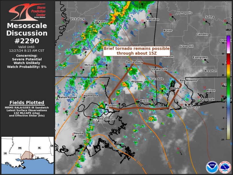
   SUMMARY...A low-probability, brief tornado risk may persist through
   the rest of mid-morning across southeast Mississippi.

   DISCUSSION...A confluent band of mainly discrete convection has
   persisted over the past couple hours, generally perpendicular to a
   northwest/southeast-oriented warm front that is roughly approaching
   a PIB to MOB line. Transient supercell structures have been noted,
   and these may persist through about 15Z. The 12Z LIX RAOB sampled a
   bit of near-surface stability, but otherwise contained a
   conditionally favorable buoyancy/shear space for a supercell
   tornado. As noted in the 13Z SWODY1, the background synoptic
   environment is unlikely to support substantially greater
   organization. In conjunction, with further waning of large-scale
   ascent, overall tornado potential in this area should be brief and
   temporally diminish by late morning.

   ..Grams/Edwards.. 12/27/2024

   ...Please see www.spc.noaa.gov for graphic product...

   ATTN...WFO...MOB...JAN...LIX...

   LAT...LON   31398902 31288834 30968788 30828772 30268808 30238845
               30278896 30228946 30288971 30538972 31188918 31398902
|
|
|
Top/All Mesoscale Discussions/Forecast Products/Home |
|


