| Mesoscale Discussion 2267 | |
| < Previous MD | |

|
|
   Mesoscale Discussion 2267
   NWS Storm Prediction Center Norman OK
   0447 AM CST Wed Dec 24 2025

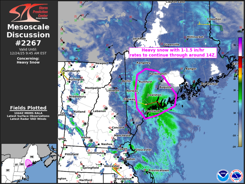
   Areas affected...Parts of southern Maine

   Concerning...Heavy snow

   Valid 241047Z - 241445Z

   SUMMARY...Band of heavy snow with 1-1.5 in/hr rates to continue
   across parts of southern Maine through around 14Z.

   DISCUSSION...Within the left exit region of a robust mid/upper-level
   jet streak and to the north of a surface low just offshore of
   coastal Maine, strong low-level frontogenesis and convergence is
   yielding strong mesoscale and large-scale forcing for ascent over
   southern Maine. Here, a cold/saturated profile, substantial lift
   within the DGZ, and light winds within the DGZ will favor a
   continuation of heavy snowfall rates (around 1-1.5 inches per hour).
   These heavy rates should continue through around 14Z, before the
   left-exit region ascent moves offshore.

   ..Weinman.. 12/24/2025

   ...Please see www.spc.noaa.gov for graphic product...

   ATTN...WFO...GYX...

   LAT...LON   44806982 44676962 44146910 43856918 43596984 43517027
               43797059 44297066 44697058 44857027 44806982
|
|
|
Top/All Mesoscale Discussions/Forecast Products/Home |
|
Source link


