| Mesoscale Discussion 2257 | |
| < Previous MD | |

|
|
   Mesoscale Discussion 2257
   NWS Storm Prediction Center Norman OK
   0807 AM CST Wed Dec 10 2025

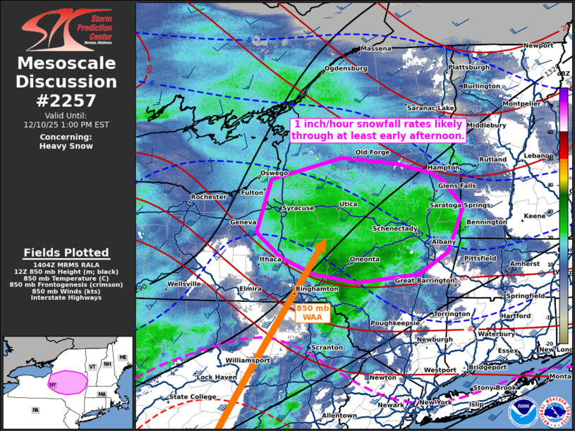
   Areas affected...portions of central into eastern New York

   Concerning...Heavy snow

   Valid 101407Z - 101800Z

   SUMMARY...Moderate to heavy snow is expected to persist into the
   late morning and perhaps early afternoon hours. A few localized
   instances of 1 inch/hour snowfall rates may occur.

   DISCUSSION...A primary band of moderate to heavy snow has become
   established over much of New York as a surface low approaches from
   the Great Lakes, resulting in increased low-level WAA over the
   Hudson Valley. At the terminus of the WAA resides strong 925-850 mb
   convergence, which may be providing enhanced lift within a
   saturated, sub-freezing troposphere. As such, efficient dendritic
   growth should result in widespread moderate to occasionally heavy
   snow through the morning hours, perhaps extending into early
   afternoon, before the aforementioned WAA axis shifts east, away from
   the Hudson Valley. Localized instances of 1 inch/hour snowfall rates
   are possible.

   ..Squitieri.. 12/10/2025

   ...Please see www.spc.noaa.gov for graphic product...

   ATTN...WFO...ALY...BGM...BUF...

   LAT...LON   42817652 43447630 43697517 43627428 43527373 43437354
               43127321 42597346 42327392 42237492 42327562 42527613
               42767646 42817652
|
|
|
Top/All Mesoscale Discussions/Forecast Products/Home |
|
Source link


