|
|
| Mesoscale Discussion 2249 | |
| < Previous MD | |

|
|
   Mesoscale Discussion 2249
   NWS Storm Prediction Center Norman OK
   1247 AM CST Thu Dec 05 2024

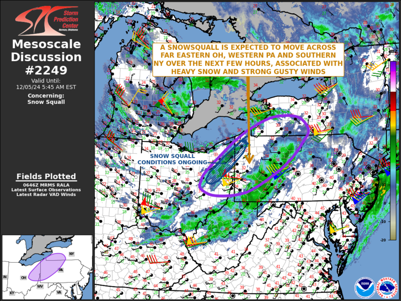
   Areas affected...Eastern and Far Northeast Ohio...Western and
   North-central Pennsylvania...Southern New York

   Concerning...Snow Squall

   Valid 050647Z - 051045Z

   SUMMARY...Snow squall conditions are expected over next several
   hours from eastern and far northeast Ohio into western and
   north-central Pennsylvania and southern New York. Heavy snow and
   strong wind gusts will be associated with these bands.

   DISCUSSION...A line of shallow convection, associated with snow and
   strong gusty winds, is located across eastern and far northeast
   Ohio. Hi-resolution 88D radar suggests that heavy snow is ongoing
   within the more intense parts of the band. In addition, the latest
   surface observations near the band are measuring wind gusts near in
   the 45 to 55 mph range. On radar, the band is moving quickly to the
   east-northeast at 50 to 60 knots, meaning that it will impact much
   of far eastern Ohio and western Pennsylvania over the next few
   hours. The snow squall is expected to remain intact as it moves into
   parts of north-central Pennsylvania and southern New York later this
   morning. Impacts from the band will be the onset of heavy snow,
   visibilities quickly dropping to less than 1/4 mile, and wind gusts
   increasing to near 55 mph.

   ..Broyles/Guyer.. 12/05/2024

   ...Please see www.spc.noaa.gov for graphic product...

   ATTN...WFO...BGM...BUF...CTP...PBZ...CLE...

   LAT...LON   41368110 40758181 40448203 40148203 39928137 40038001
               40657872 41217790 41767736 42197710 42637758 42647871
               42267975 41818051 41368110
|
|
|
Top/All Mesoscale Discussions/Forecast Products/Home |
|
Source link


