| Mesoscale Discussion 2230 | |
| < Previous MD | |

|
|
Mesoscale Discussion 2230
NWS Storm Prediction Center Norman OK
1049 AM CST Tue Nov 25 2025
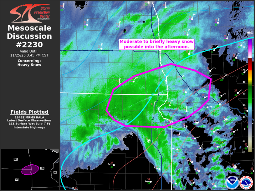
Areas affected...Northeast South Dakota...southeast North
Dakota...west-central Minnesota
Concerning...Heavy snow
Valid 251649Z - 252145Z
SUMMARY...Potential for moderate to heavy (around 1 inch per hour
rates) snowfall is expected to increase through the afternoon as the
upper trough intensifies and the surface low deepens in the Upper
Midwest.
DISCUSSION...An amplifying trough is evident on water vapor imagery
in the northern Plains. As this features continues into the Upper
Midwest, a surface low now analyzed in eastern South Dakota should
deepen and generally shift eastward. Ascent from low to mid levels
will promote a region of heavier precipitation. Recent observations
from northeast South Dakota showed heavy snow occurring.
Temperatures farther east are currently above freezing, but between
low-level cold air advection and diabatic cooling within the heavier
precipitation bands, moderate to occasionally heavy snowfall rates
(around 1 inch per hour) are probable into the mid/late afternoon.
..Wendt.. 11/25/2025
...Please see www.spc.noaa.gov for graphic product...
ATTN...WFO...MPX...FGF...ABR...BIS...
LAT...LON 45219667 45239786 45379822 45479836 45579847 46039827
46349762 46619644 46459568 46279519 45809528 45609558
45439591 45219667
|
|
|
Top/All Mesoscale Discussions/Forecast Products/Home |
|
Source link