|
|
| Mesoscale Discussion 2199 | |

|
|
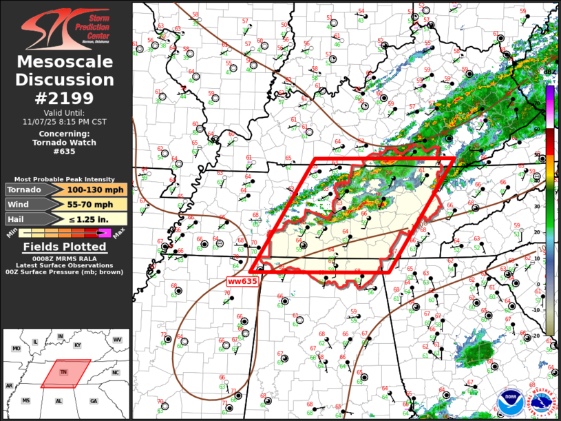
Mesoscale Discussion 2199 NWS Storm Prediction Center Norman OK 0609 PM CST Fri Nov 07 2025 Areas affected...Parts of Middle TN...south-central KY...far northern AL Concerning...Tornado Watch 635... Valid 080009Z - 080215Z The severe weather threat for Tornado Watch 635 continues. SUMMARY...Scattered strong-severe thunderstorms will propagate across the northern half of ww635 over the next several hours, with more isolated activity expected across southern portions of the watch. DISCUSSION...Southern influence of Mid-MS Valley short-wave trough appears to be affecting convection across the middle TN Valley early this evening. Water-vapor imagery suggests the back edge of large-scale support is advancing steadily east and will encourage ongoing convection to spread across the remainder of ww635, especially the northern half, over the next several hours. Latest radar data suggests a few supercells are embedded along a pre frontal corridor of convection, but this activity will be approaching a less unstable air mass toward the eastern portions of the watch. MRMS MESH cores support this weaker buoyancy with most updrafts likely generating hail at, or below severe levels. Given the shear, damaging winds remain possible, along with some risk for an isolated tornado. ..Darrow.. 11/08/2025 ...Please see www.spc.noaa.gov for graphic product... ATTN...WFO...MRX...JKL...FFC...LMK...OHX...HUN...PAH...MEG... LAT...LON 34728839 36748702 36748395 34738541 34728839 MOST PROBABLE PEAK TORNADO INTENSITY...100-130 MPH MOST PROBABLE PEAK WIND GUST...55-70 MPH MOST PROBABLE PEAK HAIL SIZE...UP TO 1.25 IN |
|
|
Top/All Mesoscale Discussions/Forecast Products/Home |
|
Source link


