|
|
| Mesoscale Discussion 2170 | |
| < Previous MD | |

|
|
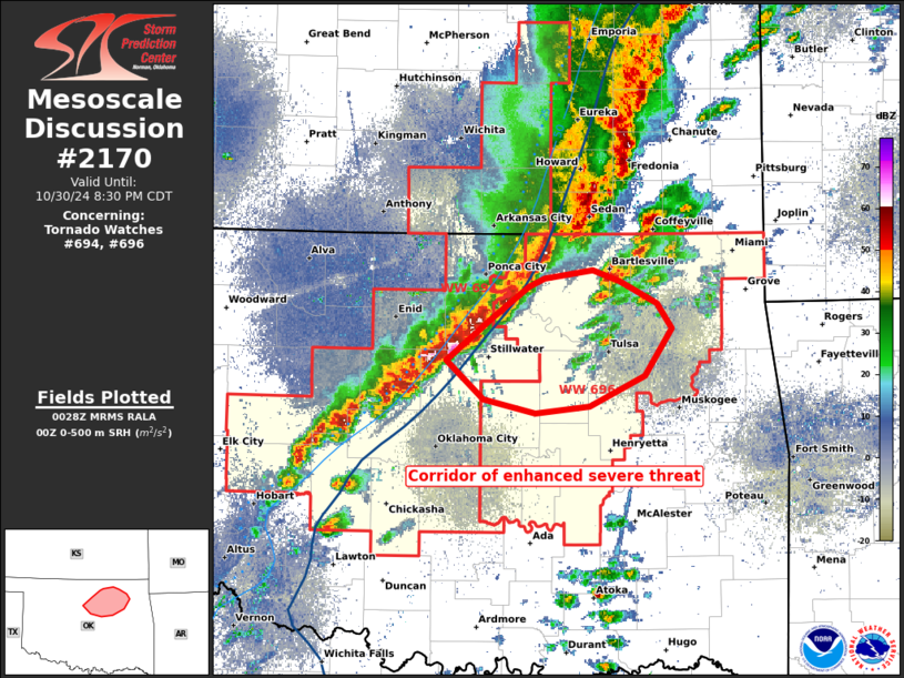
Mesoscale Discussion 2170 NWS Storm Prediction Center Norman OK 0729 PM CDT Wed Oct 30 2024 Areas affected...north-central and northeast OK Concerning...Tornado Watch 694...696... Valid 310029Z - 310130Z The severe weather threat for Tornado Watch 694, 696 continues. SUMMARY...Severe wind and isolated hail threats should persist for the next several hours. The tornado threat may increase during the next few hours, ahead of the more intense linear segment over north-central Oklahoma. DISCUSSION...IR cloud tops and MRMS MESH signatures suggest the deepest core of the evening was centered on Logan/Noble counties border area within the extensive linear band. Surface dew points ahead of this part of the band are in the mid 60s (64-65 F), with this air mass well sampled by the 00Z OUN sounding. Despite weak 700-500 mb lapse rates around 6 C/km, MLCAPE of 1500 J/kg exists with a moderately enlarged, sickle-shaped hodograph. The low-level jet in the Twin Lakes VWP has increased during the past hour. It is plausible that a sustained swath of severe wind damage, along with low-level mesocyclones capable of a couple tornadoes may evolve from this portion of the line. This may eventually impact parts of the greater Tulsa metro area by late evening. ..Grams/Hart.. 10/31/2024 ...Please see www.spc.noaa.gov for graphic product... ATTN...WFO...TSA...OUN... LAT...LON 36389705 36619671 36689657 36749615 36669590 36509558 36319545 35989568 35769618 35719666 35809711 36089744 36389705 |
|
|
Top/All Mesoscale Discussions/Forecast Products/Home |
|


