|
|
| Mesoscale Discussion 2112 | |
| < Previous MD | |

|
|
   Mesoscale Discussion 2112
   NWS Storm Prediction Center Norman OK
   0912 AM CDT Thu Sep 26 2024

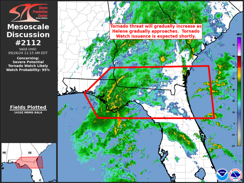
   Areas affected...southern Georgia...northern Florida and portions of
   the Florida Panhandle

   Concerning...Severe potential...Tornado Watch likely

   Valid 261412Z - 261515Z

   Probability of Watch Issuance...95 percent

   SUMMARY...Tornado threat will continue to gradually increase in
   advance of Hurricane Helene, across southern Georgia/northern
   Florida and adjacent areas.  Tornado Watch issuance will likely be
   needed in the next hour.

   DISCUSSION...Latest radar loop shows widespread rain, and
   embedded/small convective cores moving north-northwestward across
   the northeastern Gulf and adjacent portions of the Florida
   Panhandle.  Small/offshore cells are exhibiting low-level rotation,
   moving northwestward toward Gulf and Franklin Counties, southwest of
   Tallahassee.  With occasional rotation expected with convective
   elements within the broader convective bands north and northeast of
   Helene given increasingly favorable low-level shear, and thus a
   long-duration tornado risk, a Tornado Watch will likely be needed
   shortly.

   ..Goss/Mosier.. 09/26/2024

   ...Please see www.spc.noaa.gov for graphic product...

   ATTN...WFO...CHS...MLB...TBW...JAX...TAE...MOB...

   LAT...LON   30378651 31518524 31578030 29318011 29368384 29338581
               30378651
|
|
|
Top/All Mesoscale Discussions/Forecast Products/Home |
|


