|
|
| Mesoscale Discussion 2050 | |
| < Previous MD | |

|
|
   Mesoscale Discussion 2050
   NWS Storm Prediction Center Norman OK
   0341 PM CDT Mon Sep 09 2024

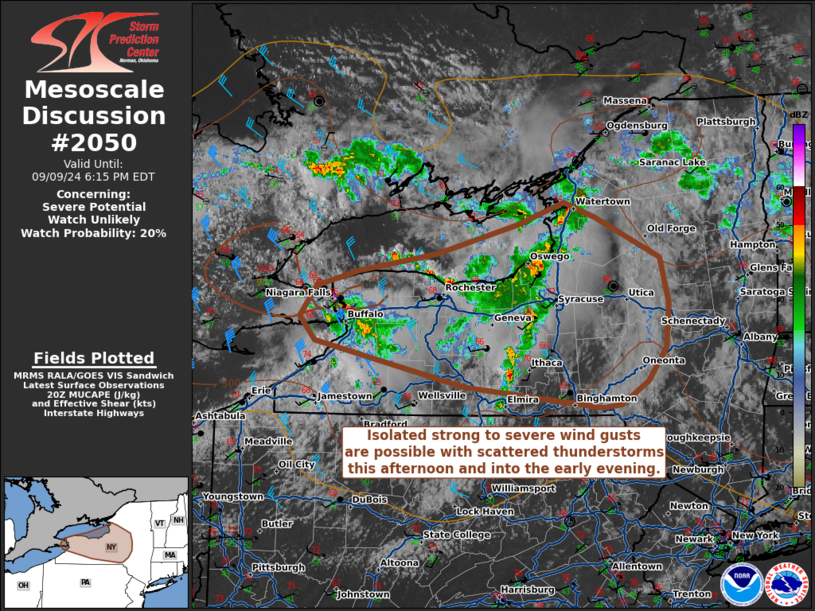
   Areas affected...Western and Central New York

   Concerning...Severe potential...Watch unlikely

   Valid 092041Z - 092215Z

   Probability of Watch Issuance...20 percent

   SUMMARY...Isolated strong to severe winds are possible with
   scattered thunderstorms across western and central New York. The
   transient and isolated nature of any severe storms will preclude
   watch issuance at this time.

   DISCUSSION...Scattered thunderstorms have moved onshore from Lake
   Ontario into New York, where the environment is characterized by
   relatively modest buoyancy of 500-1000 J/kg MUCAPE and 25-35 kts of
   deep-layer shear. Widespread cloudiness has limited daytime heating
   in the environment ahead of the convection, with surface
   temperatures mostly in the mid-to-upper 60s F. While shear and
   slight curvature of the hodograph will support transient storm
   organization, the overall severe wind threat will remain isolated
   and diminish after dark, and weather watch issuance is unlikely.

   ..Halbert/Gleason.. 09/09/2024

   ...Please see www.spc.noaa.gov for graphic product...

   ATTN...WFO...ALY...BGM...BUF...

   LAT...LON   42937947 43227925 43377871 43537769 43827664 44027604
               43897563 43507479 43057468 42637471 42317496 42097529
               42067554 42267734 42697927 42937947
|
|
|
Top/All Mesoscale Discussions/Forecast Products/Home |
|


