|
|
| Mesoscale Discussion 2048 | |
| < Previous MD | |

|
|
   Mesoscale Discussion 2048
   NWS Storm Prediction Center Norman OK
   0148 PM CDT Thu Sep 05 2024

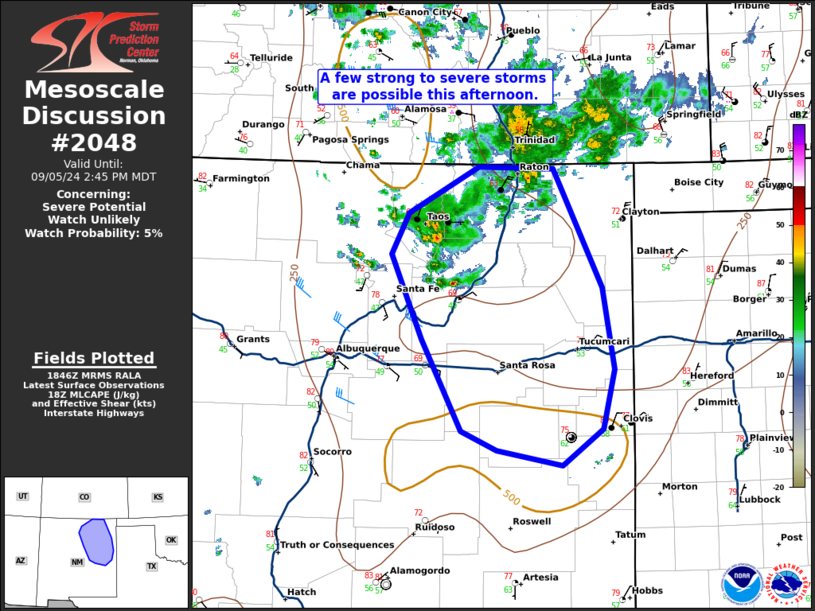
   Areas affected...northeast New Mexico and vicinity

   Concerning...Severe potential...Watch unlikely

   Valid 051848Z - 052045Z

   Probability of Watch Issuance...5 percent

   SUMMARY...A few strong to severe storms are possible this afternoon
   across northeast New Mexico.

   DISCUSSION...A few thunderstorms developed this morning and have
   continued into the early afternoon ahead of the southward moving
   mid-level shortwave trough across Colorado. These storms have been
   sub-severe thus far with a maximum wind gust of 38 knots measured at
   Taos, NM. However, surface heating is destabilizing the airmass
   ahead of this storm activity and inhibition is forecast to
   eventually erode. Once this occurs, more robust convection is
   anticipated with the potential for some multicell/occasional
   supercell structures. Through time, these storms may congeal into
   one or more clusters with an increasing threat for sporadic severe
   wind gusts into the early evening. Any severe-weather threat which
   does materialize should subside near sunset as the boundary layer
   cools and inhibition increases.

   ..Bentley/Mosier.. 09/05/2024

   ...Please see www.spc.noaa.gov for graphic product...

   ATTN...WFO...ABQ...

   LAT...LON   36500575 36970490 36940399 35760341 34950326 34370341
               34010389 34150469 34350511 35260559 36090596 36500575
|
|
|
Top/All Mesoscale Discussions/Forecast Products/Home |
|


