|
|
| Mesoscale Discussion 2035 | |
| < Previous MD | |

|
|
   Mesoscale Discussion 2035
   NWS Storm Prediction Center Norman OK
   0109 PM CDT Fri Aug 30 2024

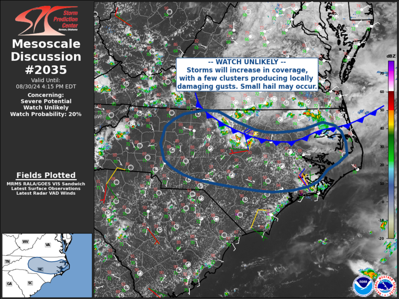
   Areas affected...much of central North Carolina

   Concerning...Severe potential...Watch unlikely

   Valid 301809Z - 302015Z

   Probability of Watch Issuance...20 percent

   SUMMARY...Storms will increase in coverage from northern into
   central North Carolina, with isolated damaging gusts possible.

   DISCUSSION...Surface analysis and visible imagery show a cold front
   extending from parts of western VA into northern/northeastern NC. A
   moist and unstable air mass exists south of this front with MLCAPE
   over 2000 J/kg, although midlevel lapse rates are poor and below 6.0
   C/km. Storms are already forming along the front, as well as north
   of the wind shift into southern VA.

   As heating continues, steepening low-level lapse rates along with
   ample precipitable water will support locally strong downdrafts.
   Although winds aloft/shear are weak, clustering of storms near the
   front may result in a few southward-propagating clusters as outflows
   merge, yielding areas of strong or locally damaging gusts.

   ..Jewell/Bunting.. 08/30/2024

   ...Please see www.spc.noaa.gov for graphic product...

   ATTN...WFO...AKQ...MHX...RAH...ILM...RNK...GSP...

   LAT...LON   35138022 35448072 35808083 36168070 36438023 36537969
               36517930 36297882 36117830 36047775 36117699 36267651
               36177618 36057602 35547588 35227639 34977666 34867692
               34757786 34967950 35138022
|
|
|
Top/All Mesoscale Discussions/Forecast Products/Home |
|


