|
|
| Mesoscale Discussion 2032 | |
| < Previous MD | |

|
|
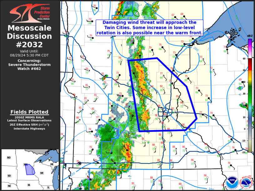
Mesoscale Discussion 2032 NWS Storm Prediction Center Norman OK 0353 PM CDT Thu Aug 29 2024 Areas affected...East Central Minnesota into Northwest Wisconsin Concerning...Severe Thunderstorm Watch 662... Valid 292053Z - 292230Z The severe weather threat for Severe Thunderstorm Watch 662 continues. SUMMARY...Damaging wind threat will approach the Twin Cities within the next hour. Potential for low-level rotation/QLCS brief tornadoes can also be expected near the warm front. DISCUSSION...The most organized line of storms in WW 662 are west and northwest of the Twin Cities area. KMPX shows signs of a stronger outflow surge just west of the metro area. This would pose the greatest risk for severe/damaging gusts in the next hour. Additionally, storms will encounter more backed low-level winds near the warm front. Some increase in low-level rotation within the line is also possible over the next 1-2 hours. ..Wendt.. 08/29/2024 ...Please see www.spc.noaa.gov for graphic product... ATTN...WFO...DLH...MPX... LAT...LON 44479412 46279455 46339349 45619242 44789208 44499248 44479378 44479412 |
|
|
Top/All Mesoscale Discussions/Forecast Products/Home |
|


