|
|
| Mesoscale Discussion 1984 | |
| < Previous MD | |

|
|
   Mesoscale Discussion 1984
   NWS Storm Prediction Center Norman OK
   0349 PM CDT Sat Aug 24 2024

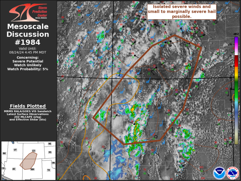
   Areas affected...Northwest New Mexico into south-central Colorado

   Concerning...Severe potential...Watch unlikely

   Valid 242049Z - 242245Z

   Probability of Watch Issuance...5 percent

   SUMMARY...Strong to severe winds and small to marginally severe hail
   are possible in the strongest storms. A watch is not likely this
   afternoon.

   DISCUSSION...A plume of mid-level moisture is lifting northward into
   the Four Corners vicinity on water vapor imagery. Widely-scattered
   to scattered storms have developed in the higher terrain this
   afternoon. Most storms have remained rather shallow, but a cluster
   of stronger storms has formed in northwest New Mexico where greater
   heating has occurred. With a belt of stronger mid-level winds
   between the Northwestern upper trough and the central U.S. upper
   ridge, effective shear of 35-40 kts will allow a few stronger
   multicells to develop. These storms could produce strong severe wind
   gusts as well as small to marginally severe hail. Overall forcing
   for ascent will remain weak as will buoyancy. The severe threat
   should remain isolated and marginal.

   ..Wendt/Guyer.. 08/24/2024

   ...Please see www.spc.noaa.gov for graphic product...

   ATTN...WFO...PUB...BOU...ABQ...GJT...FGZ...

   LAT...LON   34330840 35370993 37220833 38350699 38780582 38240447
               35760545 34500661 34330840
|
|
|
Top/All Mesoscale Discussions/Forecast Products/Home |
|


