|
|
| Mesoscale Discussion 1954 | |
| < Previous MD | |

|
|
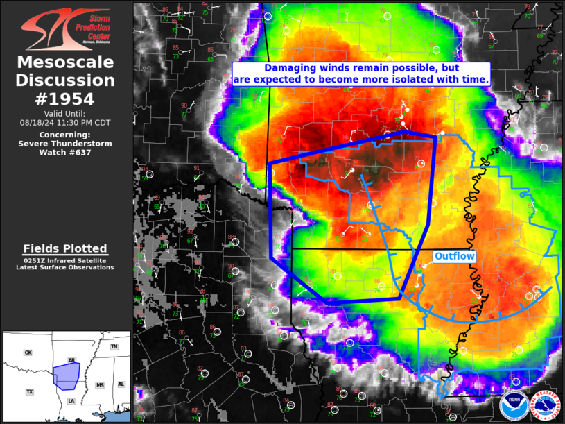
Mesoscale Discussion 1954 NWS Storm Prediction Center Norman OK 0958 PM CDT Sun Aug 18 2024 Areas affected...Portions of southern Arkansas into northern Louisiana Concerning...Severe Thunderstorm Watch 637... Valid 190258Z - 190430Z The severe weather threat for Severe Thunderstorm Watch 637 continues. SUMMARY...An organized line of convection, though becoming increasingly elevated, will produce occasional wind damage in southern Arkansas and northern Louisiana. A downstream watch is not anticipate tonight. DISCUSSION...Cold cloud tops are evident on IR satellite imagery in central Arkansas. Convection has maintained some intensity despite moving into outflow from earlier convection. The observed Little Rock 00Z sounding showed stable low-level conditions, but steep lapse rates aloft and ample elevated buoyancy. Farther south, when modifying the observed 00Z Shreveport sounding, MLCIN has been increasing with time. Given the organization of the line and the elevated buoyancy in the region, a few downdrafts may be able to overcome low-level inhibition and produce isolated wind damage tonight. Overall convective/observational trends suggest that a new watch into parts of northern Louisiana is not likely. ..Wendt.. 08/19/2024 ...Please see www.spc.noaa.gov for graphic product... ATTN...WFO...JAN...LZK...SHV... LAT...LON 34189441 34339371 34629220 34549168 33359183 32349231 32279347 32899437 34189441 |
|
|
Top/All Mesoscale Discussions/Forecast Products/Home |
|


