|
|
| Mesoscale Discussion 1951 | |
| < Previous MD | |

|
|
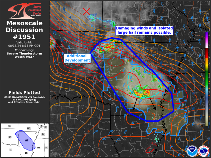
Mesoscale Discussion 1951 NWS Storm Prediction Center Norman OK 0613 PM CDT Sun Aug 18 2024 Areas affected...Northwest Arkansas into east-central Mississippi Concerning...Severe Thunderstorm Watch 637... Valid 182313Z - 190115Z The severe weather threat for Severe Thunderstorm Watch 637 continues. SUMMARY...Damaging winds and isolated large hail will remain possible into the early evening. Storms in northwest and south-central Arkansas will pose the greatest risk of these hazards. DISCUSSION...Scattered storm development in central Arkansas has produced a cold pool that is pushing south and east. Storms, particularly along the southern edge where it is more unstable, continue to develop. Recently, Pine Bluff gusted to 44 kts as storms moved through. this activity will continue to pose a risk for damaging winds and isolated large hail as it progresses south/southeast. In Northwest Arkansas, additional storms are beginning to develop as a weakening MCV/cold pool moves into the strongly buoyant airmass. Wind gusts of 44-56 kts have already been observed with this activity. Isolated large hail may also occur within initially discrete updrafts. The airmass in west-central Arkansas has thus far not been affected by convection and this activity may tend to propagate into this area. ..Wendt.. 08/18/2024 ...Please see www.spc.noaa.gov for graphic product... ATTN...WFO...MEG...JAN...LZK...SGF...SHV...TSA... LAT...LON 35979528 36519477 36719404 36669352 35249180 35219169 34069057 33219048 32759136 32759200 32889231 33189310 35979528 |
|
|
Top/All Mesoscale Discussions/Forecast Products/Home |
|


