|
|
| Mesoscale Discussion 1938 | |
| < Previous MD | |

|
|
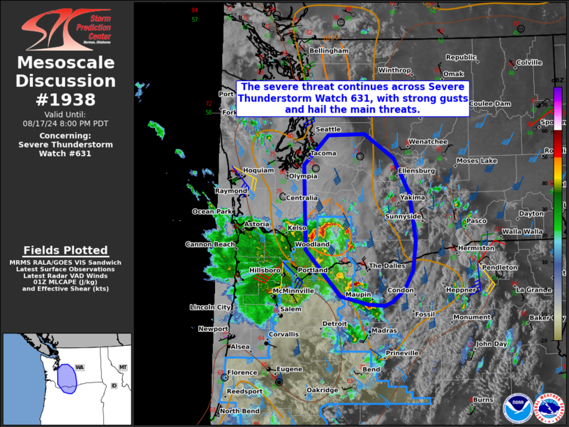
Mesoscale Discussion 1938 NWS Storm Prediction Center Norman OK 0824 PM CDT Sat Aug 17 2024 Areas affected...portions of far northern Oregon into central Washington Concerning...Severe Thunderstorm Watch 631... Valid 180124Z - 180300Z The severe weather threat for Severe Thunderstorm Watch 631 continues. SUMMARY...The severe threat continues across Severe Thunderstorm Watch 631. Damaging gusts and hail are the main threats over the next few hours. DISCUSSION...A band of multicells and transient supercells continue to progress northward in conjunction with a 700 mb impulse/500 mb speed max, with a history of occasional 1 inch hail reports. These storms will continue to progress into an unstable airmass, characterized by at least 500-1000 J/kg MLCAPE. With 40-50 kts of effective bulk shear overspreading this buoyancy axis, the ongoing storms may remain organized for at least a few more hours, accompanied by a continued strong gust/hail threat. ..Squitieri.. 08/18/2024 ...Please see www.spc.noaa.gov for graphic product... ATTN...WFO...PDT...SEW...PQR... LAT...LON 45892249 47142253 47592202 47602124 47252061 46732027 46022015 45582021 45312038 45122066 45072080 45092115 45212175 45892249 |
|
|
Top/All Mesoscale Discussions/Forecast Products/Home |
|


