|
|
| Mesoscale Discussion 1928 | |
| < Previous MD | |

|
|
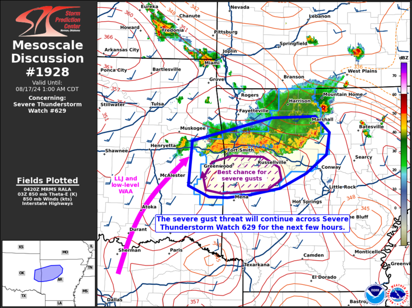
Mesoscale Discussion 1928 NWS Storm Prediction Center Norman OK 1123 PM CDT Fri Aug 16 2024 Areas affected...portions of extreme eastern Oklahoma into central Arkansas Concerning...Severe Thunderstorm Watch 629... Valid 170423Z - 170600Z The severe weather threat for Severe Thunderstorm Watch 629 continues. SUMMARY...The severe threat continues across Severe Thunderstorm Watch 629. Damaging gusts remain the main threat with these storms over the next few hours. DISCUSSION...An MCS has materialized from congealing storms over the last few hours, with strong wind gusts over 50 mph recently reported. Preceding the eastern portion of the MCS is a cooler airmass, characterized by surface temperatures in the upper 70s to low 80s F. However, along the western periphery of the MCS track are warmer surface temperatures between 85-90 F, which also reside beneath the eastern periphery of a modest LLJ and accompanying WAA. As such, the portion of the MCS cold pool propagating into this airmass has the greatest chance for supporting stronger updrafts and corresponding downdrafts, which may penetrate the increasing MLCINH. Here, a few additional strong to severe gusts may occur over the next few hours. ..Squitieri.. 08/17/2024 ...Please see www.spc.noaa.gov for graphic product... ATTN...WFO...LZK...TSA... LAT...LON 35609511 36009344 36019253 35739224 35359230 35039274 34799328 34689389 34629436 34649475 34829518 35609511 |
|
|
Top/All Mesoscale Discussions/Forecast Products/Home |
|


