|
|
| Mesoscale Discussion 1856 | |
| < Previous MD | |

|
|
   Mesoscale Discussion 1856
   NWS Storm Prediction Center Norman OK
   0756 AM CDT Wed Aug 07 2024

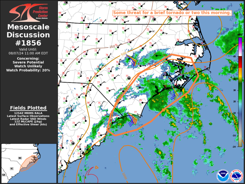
   Areas affected...Parts of coastal NC into extreme northeast SC

   Concerning...Severe potential...Watch unlikely

   Valid 071256Z - 071500Z

   Probability of Watch Issuance...20 percent

   SUMMARY...Some threat for a brief tornado or two may develop this
   morning.

   DISCUSSION...Multiple bands of convection to the northeast of
   Tropical Storm Debby are approaching coastal NC this morning, with
   occasional weak rotation noted offshore. Widespread cloudiness will
   inhibit diurnal heating inland today, but tropical moisture will
   continue to support MLCAPE of 1000-1500 J/kg near the coast, where
   temperatures can remain in the upper 70s to near 80 F (as noted on
   the 12Z MHX sounding).

   Low-level shear remains somewhat favorable for transient rotating
   cells, with 0-1 km SRH generally in the 100-200 m2/s2 range for
   observed storm motions this morning. As Debby gradually moves
   east-northeastward, slightly stronger low-level flow may overspread
   parts of coastal NC through the day, maintaining a low but
   persistent threat for a brief tornado, should any stronger cells
   develop and be sustained within banded convection over the northeast
   quadrant of Debby.

   ..Dean/Edwards.. 08/07/2024

   ...Please see www.spc.noaa.gov for graphic product...

   ATTN...WFO...MHX...RAH...ILM...

   LAT...LON   34317873 35117800 35667686 35557617 35047591 34567628
               34087713 33727759 33487808 33307883 33467910 33947899
               34317873
|
|
|
Top/All Mesoscale Discussions/Forecast Products/Home |
|


