|
|
| Mesoscale Discussion 1837 | |
| < Previous MD | |

|
|
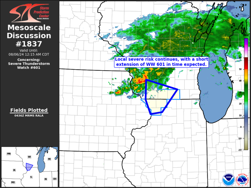
Mesoscale Discussion 1837 NWS Storm Prediction Center Norman OK 1138 PM CDT Mon Aug 05 2024 Areas affected...parts of southern Wisconsin and northwestern Illinois Concerning...Severe Thunderstorm Watch 601... Valid 060438Z - 060515Z The severe weather threat for Severe Thunderstorm Watch 601 continues. SUMMARY...Local severe risk may continue for another 1 to 2 hours across southwestern Wisconsin and far northwestern Illinois. WW 601 will likely be extended in time, beyond its scheduled 06/05Z expiration, to cover this ongoing threat. DISCUSSION...Latest radar loop shows a cluster of strong/severe storms moving east-southeastward out across southwestern Wisconsin, out of WW 600 and into WW 601. Low-level moisture/instability diminishes with eastward extent across southern Wisconsin, where an easterly low-level lake fetch is indicated. However, ample instability -- particularly across Grant and Iowa Counties in Wisconsin and areas directly south in northwestern Illinois -- remains, which should allow this cluster of storms to persist awhile longer. With some accompanying severe risk -- mainly in the form of damaging wind -- to affect these counties, WW 601 will likely be extended in time to cover this potential. ..Goss.. 08/06/2024 ...Please see www.spc.noaa.gov for graphic product... ATTN...WFO...LOT...MKX...DVN...ARX... LAT...LON 43199040 42858889 42048962 41979019 42489043 43199040 |
|
|
Top/All Mesoscale Discussions/Forecast Products/Home |
|


