|
|
| Mesoscale Discussion 1834 | |
| < Previous MD | |

|
|
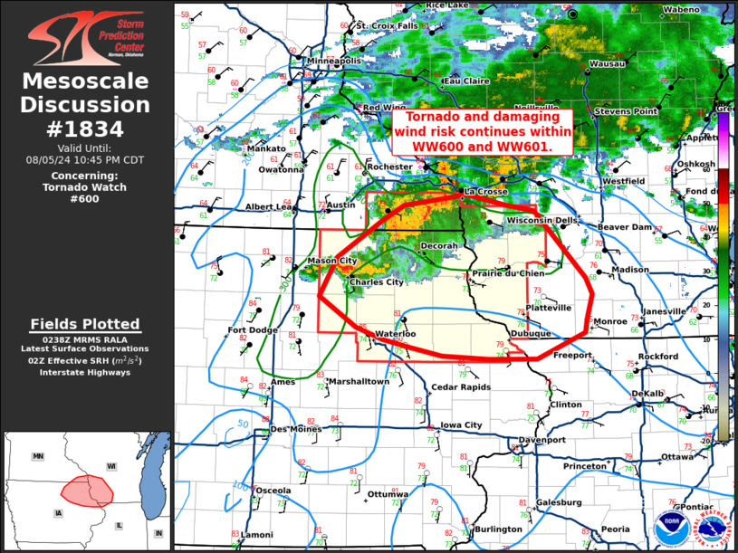
Mesoscale Discussion 1834 NWS Storm Prediction Center Norman OK 0940 PM CDT Mon Aug 05 2024 Areas affected...far southeastern Minnesota...northeastern Iowa...southwestern Wisconsin Concerning...Tornado Watch 600... Valid 060240Z - 060345Z The severe weather threat for Tornado Watch 600 continues. SUMMARY...Tornado and damaging wind risk to continue within WW600 and WW601. DISCUSSION...A line of storms with embedded supercell structures continues southeastward across far southeast MN into northeastern IA. Conditions remain favorable for a tornado or two, given effective SRH around 400 m2/s2 across northeast IA into southwestern WI. This will likely be the most favorable corridor for potential tornado development in the short term. With further linear evolution expected, potential for damaging winds will continue as this broken line advances southeastward into portions of Wisconsin and northern Illinois through the late evening. ..Thornton.. 08/06/2024 ...Please see www.spc.noaa.gov for graphic product... ATTN...WFO...MKX...DVN...ARX...DMX... LAT...LON 42439190 42509223 42619256 42889301 43249280 43589224 43739196 43829118 43729067 43679034 43058969 42918961 42688968 42568970 42319031 42329091 42349149 42439190 |
|
|
Top/All Mesoscale Discussions/Forecast Products/Home |
|


