|
|
| Mesoscale Discussion 1825 | |
| < Previous MD | |

|
|
   Mesoscale Discussion 1825
   NWS Storm Prediction Center Norman OK
   1258 PM CDT Mon Aug 05 2024

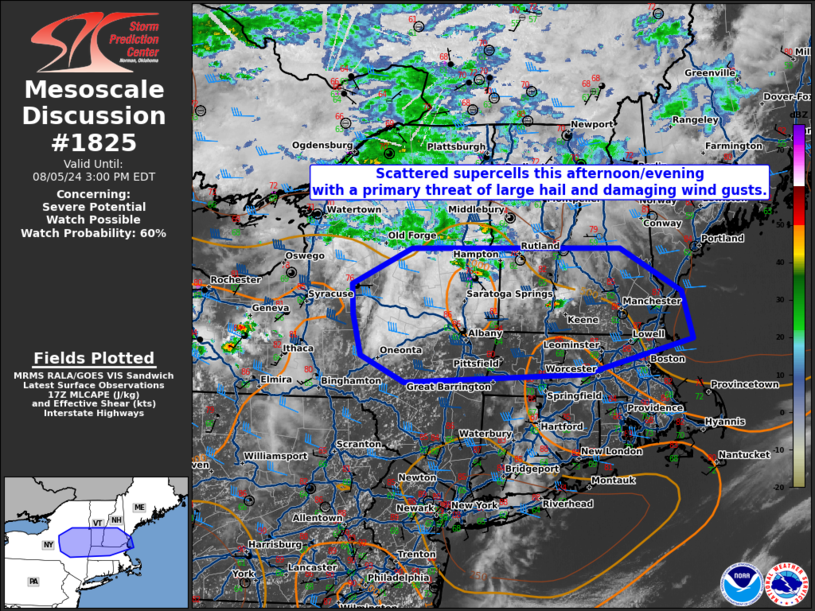
   Areas affected...eastern New York...southern New Hampshire and
   Vermont...and northern Massachusetts.

   Concerning...Severe potential...Watch possible

   Valid 051758Z - 051900Z

   Probability of Watch Issuance...60 percent

   SUMMARY...Scattered supercells are possible this afternoon/evening
   with a primary threat of large hail and damaging wind gusts.

   DISCUSSION...Temperatures have warmed into the low to mid 80s south
   of a stationary front from eastern New York to near Boston with
   MLCAPE around 500 to 1000 J/kg. Expect instability to increase this
   afternoon with scattered thunderstorm development likely along the
   frontal zone. 35 to 45 knots of westerly shear will support
   supercells and a threat for large hail and potentially some damaging
   wind gusts. This threat should primarily exist during peak heating
   with storm intensity expected to wane near sunset.

   ..Bentley/Hart.. 08/05/2024

   ...Please see www.spc.noaa.gov for graphic product...

   ATTN...WFO...GYX...BOX...BTV...ALY...BGM...

   LAT...LON   42187467 42477531 42917543 43247545 43657456 43657145
               43177053 42657037 42277200 42187467
|
|
|
Top/All Mesoscale Discussions/Forecast Products/Home |
|


