|
|
| Mesoscale Discussion 1816 | |
| < Previous MD | |

|
|
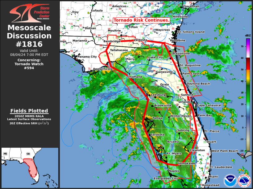
Mesoscale Discussion 1816 NWS Storm Prediction Center Norman OK 0353 PM CDT Sun Aug 04 2024 Areas affected...much of the Florida Peninsula and far southern Georgia Concerning...Tornado Watch 594... Valid 042053Z - 042300Z The severe weather threat for Tornado Watch 594 continues. SUMMARY...The tornado risk continues across FL and far southern GA. The greatest risk should gradually drift north toward the FL/GA border later this evening. DISCUSSION...As of 2045 UTC, convection associated with the outer bands of TS Debby continues to move across the central and northern FL Peninsula. Periodic updraft rotation has been noted with some of the stronger cells over the last several hours. However, the expanding CDO noted with Debby's outflow has gradually expanded inland, limiting diurnal heating. MLCAPE has started to decrease below 1000 J/kg reducing overall convective intensity of the observed bands. That, in combination with a more linear dominant storm mode, has stifled tornado potential somewhat so far this afternoon. Still, as Debby continues to deepen, already strong low-level shear (TBW VAD 600+ m2/s2 ESRH) should continue to intensify and shift northeast of the center. This will support low-level updraft rotation and the potential for a few tornadoes with any sustained convection. ..Lyons.. 08/04/2024 ...Please see www.spc.noaa.gov for graphic product... ATTN...WFO...MFL...MLB...TBW...JAX...TAE... LAT...LON 30498442 30838423 30908291 30798195 30068151 29288112 28288076 27408059 26758085 26358123 26298147 26328179 26488223 26968245 27848283 28708261 29128294 29648357 29908419 30498442 |
|
|
Top/All Mesoscale Discussions/Forecast Products/Home |
|


