|
|
| Mesoscale Discussion 1573 | |
| < Previous MD | |

|
|
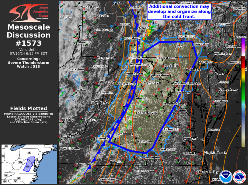
Mesoscale Discussion 1573 NWS Storm Prediction Center Norman OK 0322 PM CDT Wed Jul 10 2024 Areas affected...Central Virginia into south-central Pennsylvania Concerning...Severe Thunderstorm Watch 518... Valid 102022Z - 102215Z The severe weather threat for Severe Thunderstorm Watch 518 continues. SUMMARY...Additional storm development is possible along the cold front moving through the Mid-Atlantic. Damaging winds will be the primary risk late this afternoon into the evening. DISCUSSION...Lack of mid-level ascent has likely contributed to storm coverage and intensity being rather low near the Blue Ridge. However, with the cold front moving through the region, additional storms may develop and organize along this front late this afternoon. Temperatures broadly in the low/mid 90s F have contributed to 2500+ J/kg MLCAPE. Storm organization will be greater farther north given the proximity to the mid-level jet, but cold pool mergers could lead to linear structures farther south. Damaging winds remain the primary threat. ..Wendt.. 07/10/2024 ...Please see www.spc.noaa.gov for graphic product... ATTN...WFO...AKQ...CTP...LWX...RNK... LAT...LON 37227942 38547856 39857820 40177758 40187634 39697615 38317700 37517757 37077782 36907807 36977866 37227942 |
|
|
Top/All Mesoscale Discussions/Forecast Products/Home |
|


