2024-07-02 20:04:05
1719965483
|
|
| Mesoscale Discussion 1517 | |
| < Previous MD | |

|
|
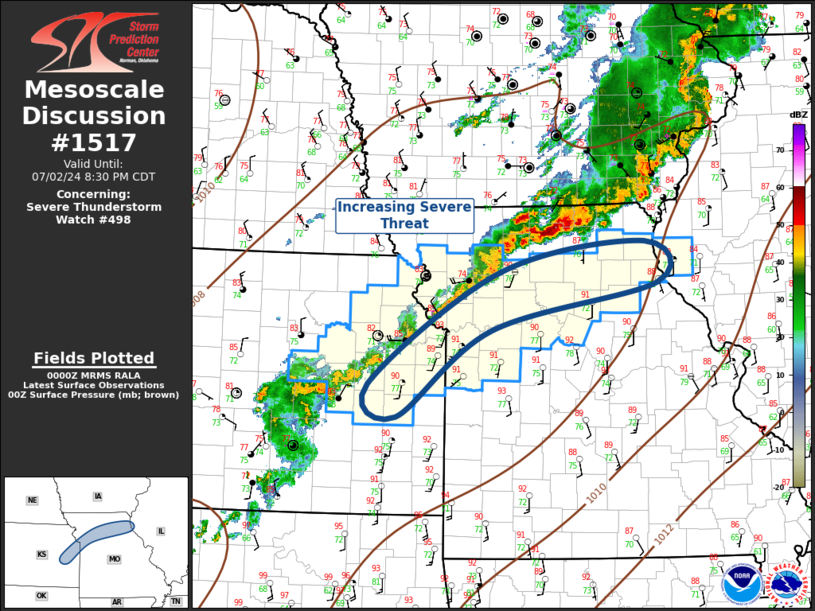
Mesoscale Discussion 1517 NWS Storm Prediction Center Norman OK 0702 PM CDT Tue Jul 02 2024 Areas affected...Northeast Kansas...Northern Missouri Concerning...Severe Thunderstorm Watch 498... Valid 030002Z - 030130Z The severe weather threat for Severe Thunderstorm Watch 498 continues. SUMMARY...Convective threat will increase across northeast Kansas and northern Missouri this evening. DISCUSSION...Southern influence of central Plains short-wave trough is beginning to affect the lower MO Valley region. Height falls will glance northeast KS/northern MO this evening and this should encourage a gradual expansion of convection along/ahead of surface front. Additionally, LLJ is forecast to strengthen into northern MO in response to the approaching short wave. This is expected to aid a potential MCS that will sag southeast across a reservoir of strong buoyancy (3000 J/kg MLCAPE). Primary risk remains damaging winds. ..Darrow.. 07/03/2024 ...Please see www.spc.noaa.gov for graphic product... ATTN...WFO...LSX...EAX...TOP... LAT...LON 38509576 39829378 40179163 39689145 39149393 38139533 38509576 |
|
|
Top/All Mesoscale Discussions/Forecast Products/Home |
|


