2024-07-02 19:10:06
1719962819
|
|
| Mesoscale Discussion 1515 | |
| < Previous MD | |

|
|
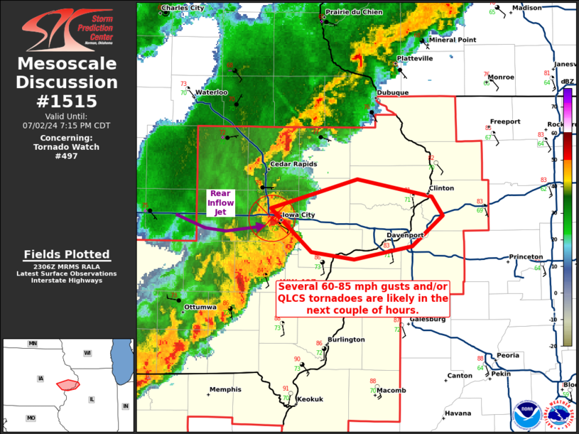
Mesoscale Discussion 1515 NWS Storm Prediction Center Norman OK 0609 PM CDT Tue Jul 02 2024 Areas affected...portions of eastern Iowa Concerning...Tornado Watch 497... Valid 022309Z - 030015Z The severe weather threat for Tornado Watch 497 continues. SUMMARY...A focused corridor of 60-85 mph wind gusts is expected with a bowing line segment across eastern IA. DISCUSSION...A QLCS continues to move across eastern IA, with a pronounced line-end mesovortex currently located over Johnson County, IA, tracking eastward. Immediately south of the mesovortex is a rear-inflow jet, where a measured 81 mph wind gust was recently reported and where a tornado was also reported. The current expectation is that this coupled mesovortex/rear-inflow jet structure will progress within the QLCS for at least the next hour or two, accompanied by a narrow but focused swath of severe gusts in the 60-85 mph range. ..Squitieri.. 07/02/2024 ...Please see www.spc.noaa.gov for graphic product... ATTN...WFO...DVN... LAT...LON 41739161 41939083 41829014 41699005 41489033 41399086 41449124 41739161 |
|
|
Top/All Mesoscale Discussions/Forecast Products/Home |
|


