2024-07-02 19:10:06
1719961998
|
|
| Mesoscale Discussion 1514 | |
| < Previous MD Next MD > | |

|
|
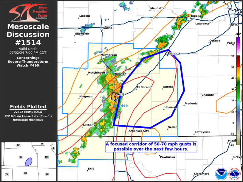
Mesoscale Discussion 1514 NWS Storm Prediction Center Norman OK 0558 PM CDT Tue Jul 02 2024 Areas affected...portions of south-central Kansas Concerning...Severe Thunderstorm Watch 499... Valid 022258Z - 030000Z The severe weather threat for Severe Thunderstorm Watch 499 continues. SUMMARY...A focused corridor of strong to severe wind gusts (50-70 mph) may accompany a rapidly propagating bowing MCS across southern KS. DISCUSSION...An MCS has recently organized across southern KS over the past couple of hours. This MCS has recently shown some bowing structure, with rapid propagation speeds potentially exceeding 50 mph, and several estimated and measured severe gusts reported. Preceding this bow-echo MCS is a deep, mixed boundary layer, characterized by 8-9 C/km 0-3 km lapse rates per 22Z mesoanalysis. This favorable boundary layer may foster efficient evaporative cooling to support a focused corridor (through the axis of steepest low-level lapse rates) of strong to severe gusts within the 50-70 mph range for at least a few more hours. ..Squitieri.. 07/02/2024 ...Please see www.spc.noaa.gov for graphic product... ATTN...WFO...TOP...ICT... LAT...LON 37189735 37909715 38359670 38499616 38269590 37789582 37349610 37149654 37189735 |
|
|
Top/All Mesoscale Discussions/Forecast Products/Home |
|


